Order Digital Reprints
Filed Under
Sign Me Up!
Sign up Digital!
Subscribe to Print!
Interested in Location/Detection?
Get Location/Detection articles, news and videos right in your inbox! Sign up now.
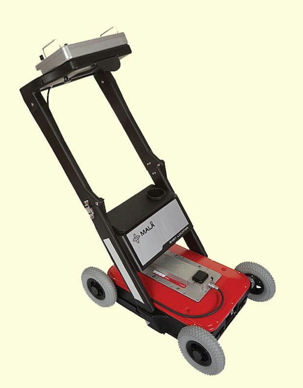
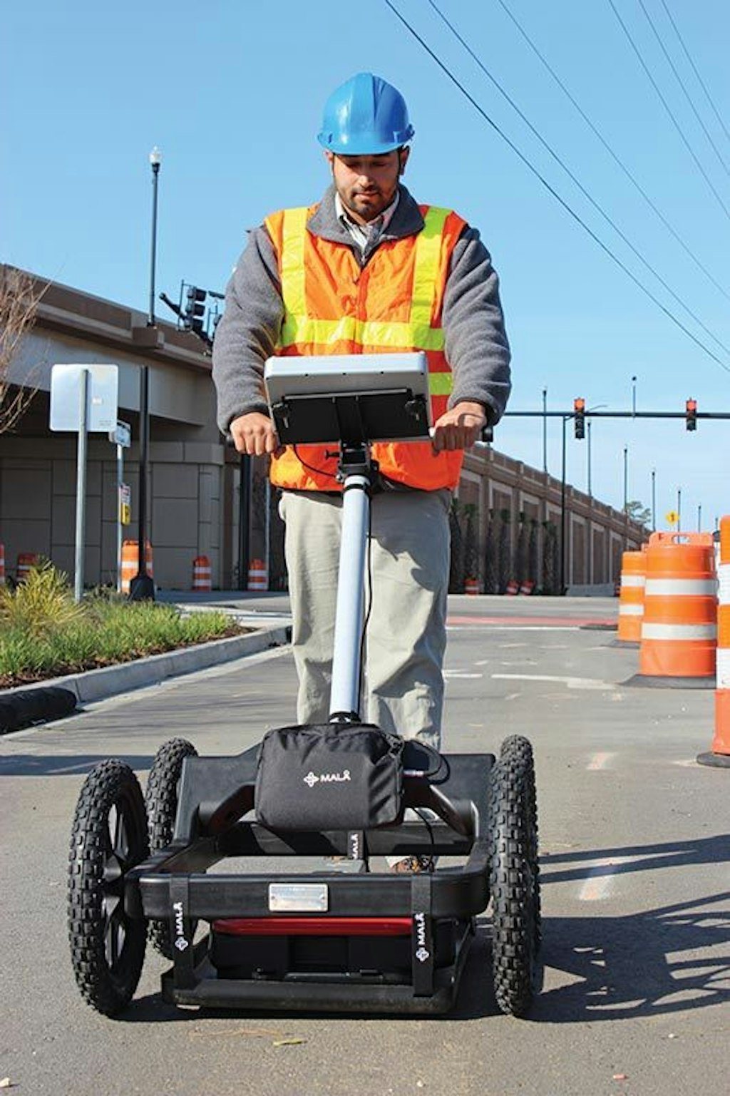
Location/Detection + Get AlertsThe Easy Locator HDR (high dynamic range) penetrating radar from MALA is designed to specifically detect metallic and non-metallic utilities. Taking a slice of the ground below, the monitor’s zoom function enables the user to view small, near-surface objects or zoom out to view deeper targets, including plastic, asphalt composite, concrete, terracotta and other non-conductive objects.
“The radar is non-contacting. It doesn’t have to have a signal coupled to it. It doesn’t use tracer wires,” says Matt Wolf, president, MALA Geoscience USA Inc. “It puts electromagnetic energy into the ground and receives it back, very similar to sonar.”
Unlike standard locating tools, penetrating radar does not require prior knowledge of what lies beneath the surface, Wolf says. “This is kind of an odd thing to say, but you more or less have to know where the utility is to actually locate it using electromagnetics (EM). Now with radar, you can sweep the ground and see indications that utilities are there and you can trace it, having no knowledge that there’s a junction box or some kind of connection down the pathway or road. So it’s a good tool to do a blind sweep and survey an area at the same time for utilities underground.”
The all-in-one HDR unit (26 by 19 by 7 inches, excluding handle) has a folding hinged shaft for easy transport and molded plastic aluminum casing to protect sensitive components from weather and harsh environments. Powered by a 12-volt lithium-ion battery, it has an operating temperature of -20 to 120 degrees F and 450 MHz HDR antenna. Maximum operating speed is approximately 15 mph with a scan rate of 1,024 scans per second.
“When we say the center frequency on our transducer transistor is 450 MHz, that’s not telling the whole story,” Wolf says. “It’s really a transducer that emits energy well above that frequency and well below it. In the past, we were never able to digitally capture the outer edges of that energy. But because of advances in computers, we are now able to pull out energy and data on the farther extremes of that center frequency. What the user now gets is about 20 percent more ground penetration with increased resolution.”
Delivering up to 14 hours of run time, the HDR locator has a built-in DGPS (differential global positioning system) receiver for simplified positioning of identified utilities and upgradable GPS Mapper software for digital utility mapping using the 10.4-inch color TFT, sunlight readable LCD monitor. The system’s screen capture function enables the user to create screen shots in JPEG format to record and archive.
“You basically turn it on, hit start, and as you’re walking along, the data starts scrolling. It looks just like a fish-finder,” Wolf says. A chevron-like image targets underground objects, which can be marked and evaluated for depth.
“If you want to trace just that line, you make a 180-degree turn and come back over it a few feet away [until you see the chevron].” 843/852-5021; www.malags.com.