Order Digital Reprints
Sign Me Up!
Sign up Digital!
Subscribe to Print!
Interested in Inspection?
Get Inspection articles, news and videos right in your inbox! Sign up now.
Inspection + Get Alerts
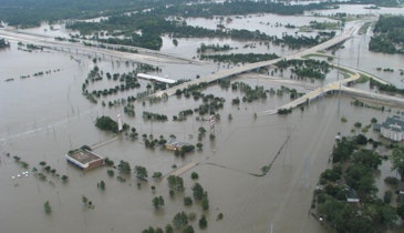
Getting a clear picture of underground assets has always been difficult. As-built plans and paper inspection records are often incomplete or inaccurate, and locating buried lines is labor intensive.
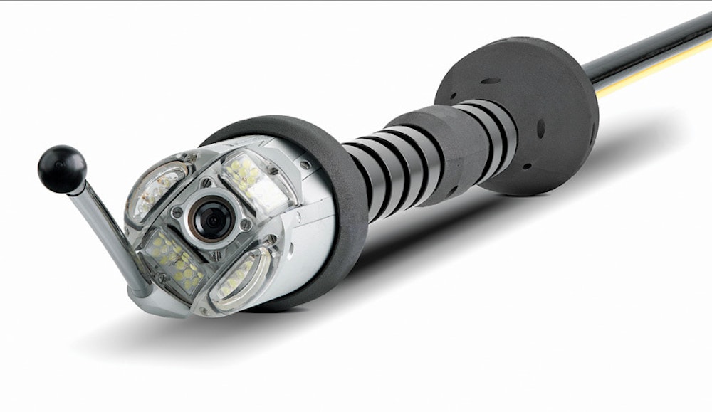
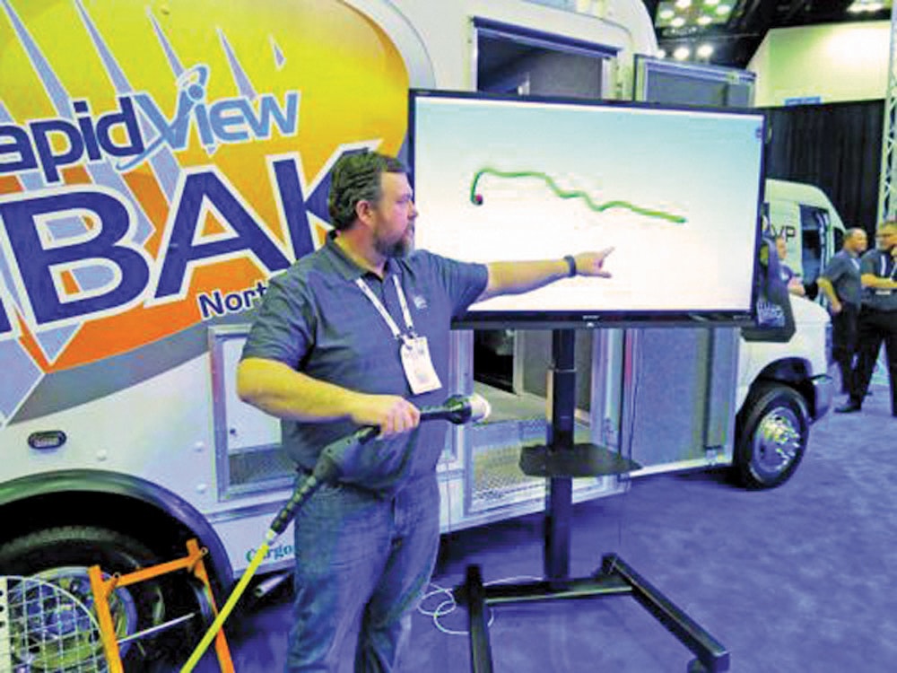
For years, the best way to map wastewater infrastructure has been a sonde and locator, but RapidView has addressed this issue with a new tool designed to provide a complete picture of buried lines in real time. The new 3D-GeoSense system provides a 3-D picture from within the pipe, eliminating guesswork.
Matthew Sutton, RapidView’s vice president of sales and marketing, recently discussed the system with Municipal Sewer & Water.
What’s the philosophy behind development and innovation at RapidView?
RapidView is the North American partner of IBAK Helmut Hunger of Kiel, Germany. IBAK is the world’s oldest and largest manufacturer of pipeline inspection robotics. Since IBAK invented the sewer camera in 1957, they have been the driving force behind nearly every innovation in the market. They invented color inspection cameras, the first camera tractor, the first lateral launching system, the first data logging software, the first pan and tilt camera, Panoramo 360-degree scanning technology, and many more industry-defining advancements. These innovations are in common use today throughout the industry. Over 18 percent of IBAK’s staff work in research and development on a daily basis, inventing the tools we will use to inspect and rehabilitate pipelines in the future.
What was the idea behind the 3D-GeoSense system?
Underground pipelines are unseen by their very nature. Up until now, locating and defining exactly where these pipelines are has been a challenge. Often, as-built plans are incorrect or nonexistent. Typically, it required digging up the pipeline to find it, but this is often unwise or impossible. A more intensive approach to discovering where these pipelines run could be accomplished with a time-consuming procedure whereby a transmitter and locator were used to follow the inspection camera as it traveled through the pipeline. This method required periodically stopping, measuring and logging this information. Personnel were also required to follow the path of the system above ground, which is not always possible or safe. The data gathered in this manner is often inconsistent and required many hours of work. Deeper pipelines were impossible if the transmitter signal could not reach the ground. Pipelines running under obstructions, buildings or underwater were also impossible, due to the lack of access above ground.
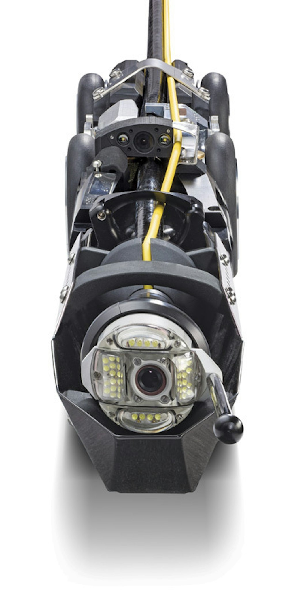
We set out to design a sensor that would track itself in 3-D space from within the pipeline. The 3D-GeoSense sensor provides real-time, accurate positional data as the system moves through the pipeline. As the system travels underground, a three-dimensional computer model of the pipeline is constructed. This model can be shared, analyzed and manipulated. It is easily shared with asset management databases or GIS systems. In addition, we had to design a sensor small enough so that it could be used in mainline and smaller lateral cameras.
We believe one of the major markets for this technology will be in the tracking and logging of house laterals prior to directional drilling. With an accurate model of the pipeline in 3-D space, the directional drilling company can program their machine to easily avoid the existing pipelines, dramatically reducing the chance of cross bores. In mainlines, this system will allow the discovery of pipeline position, depth and travel in hard-to-reach, dangerous or obstructed areas.
Is this a stand-alone system, or is it designed to work with one of your other cameras?
The 3D-GeoSense sensor is an available option in all of our new, video-based cameras. When the customer orders a new camera they can specify if they wish to have the sensor installed. In mainline applications, this is all that the customer needs, with the exception of software to view the data, which is provided by third-party software providers like WinCan.
Are there any limitations on pipe sizes and lengths the system can effectively map?
There are no limitations on pipe size or length. The sensor is inside the camera and will track its movement wherever it travels.
How is mapping information recorded and shared? Is it separate from the video file, or is the mapping information embedded?
The data is saved as a small file of XYZ coordinates. How this is displayed is determined by the software you view the data in. We expect that visualizations and analysis methods may vary from each software vendor as they integrate the data. WinCan’s integration of the 3D-GeoSense data stores the XYZ coordinates in the pipeline inspection file along with video and observations. This data can be viewed in a 3-D space in WinCan’s map module, constructing the file in real time as the system moves through the pipeline.
Therefore, anyone who views the report after the inspection could have access to this visualization in the map module or export them to CAD for further analysis. Since system owners have never had this level or accuracy of data, we are excited to see what they can do with it, and how it will be used in their inspection programs.
What type of user is this system aimed at?
The technology is so simple and cost-effective that we expect widespread adoption. Municipal engineers, planners, system owners and contractors should see the added benefit of this data immediately. What system does not have pipelines that would benefit from more accurate mapping? We also expect that this data will revolutionize the way pre-inspection occurs for gas line boring contractors.
What will the average contractor or utility gain from this tool?
What pipeline inspector hasn’t wished to know exactly where the pipeline they were in was running? What city couldn’t benefit from a more accurate, complete and visual representation of their underground infrastructure? What horizontal drilling company couldn’t benefit from knowing exactly where the laterals are underground? The 3D-GeoSense sensors in our 3-D cameras can provide this information to them at a reasonable cost and in a simple-to-use package.