
Order Digital Reprints
Filed Under
Sign Me Up!
Sign up Digital!
Subscribe to Print!
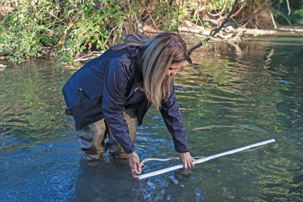
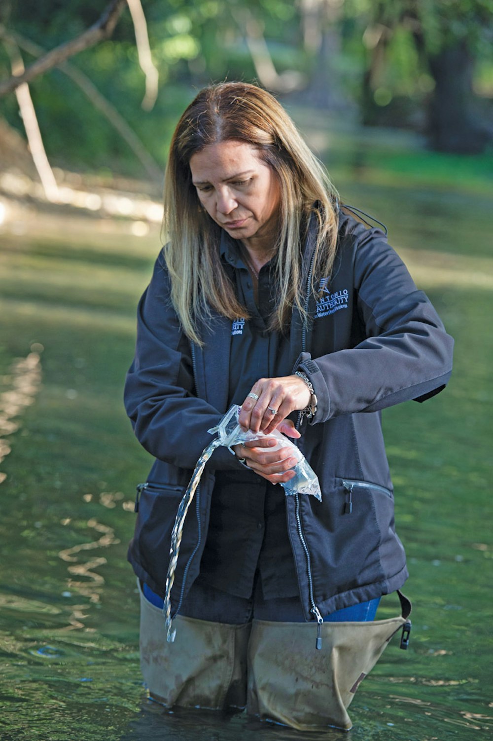
Aquatic biologist Karen Sablan collects water samples for routine quality analysis near the headwaters of the San Antonio River. The entire river basin runs from Kerr County west of San Antonio almost to the Gulf of Mexico, draining nearly 4,200 square miles and dropping some 2,400 feet in elevation along the way.
Interested in Stormwater?
Get Stormwater articles, news and videos right in your inbox! Sign up now.
Stormwater + Get AlertsEveryone knows that rainwater runoff impacts water quality. Hydrology technicians at the San Antonio River Authority want to know more than that. They have created software modeling tools that let them better predict water dispersal and more effectively manage ensuing downstream water quality.
The Authority’s innovative approach has earned it an excellence award from the Water Environment Federation, which said of the initiative: “These state-of-the-art tools are first of their kind in supporting management of stormwater quality and are getting national attention.”
It all started with senior technical engineer Dr. Sheeba Thomas. “It was San Antonio River Authority’s vision,” says Thomas, who came to work at the Texas agency a dozen years ago. “When I first came here, most of my work was with flood control, so I saw a lot of work invested in modeling. Eventually, I raised the question, ‘How can we do similar modeling work to manage water quality?’ I subsequently led the effort to make the vision a reality.”
Her previous work familiarized her with different types of models that had been developed in both public and private sectors. They ranged from simple conceptual ones to data-rich and complex models. The models predicted water volume at various points in a flood plain during a rain event and helped guide stormwater management efforts.
The Authority’s mission statement spells out its commitment to “Safe, Clean and Enjoyable Creeks and Rivers.” Thomas wanted to focus on the clean component of the mission. She says her goal was more than just planning for “how to get the stormwater out of the system.”
So, Thomas and her colleagues in the Authority systematically began to build a program to quantify runoff and in-stream water quality, a new standard of measurement.
“The first step was to identify which model to use and set standards. There are a lot of models out there. The second step was to collect the data to build the model.”
Modeling the watersheds
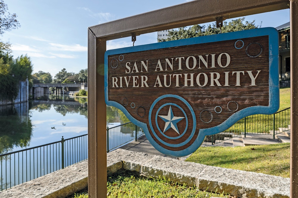
Southern Texas is a semi-arid region and water conservation is always top of mind. Voters approved a constitutional amendment in 1917 that let the Legislature create special purpose districts in water basins, terming them river authorities. Twenty years later, the San Antonio River Authority was formed.
Its jurisdiction ranges across 3,600 square miles and comprises four counties, the most populated of which is Bexar (pronounced bear) County with San Antonio as county seat. Some 2 million people reside within the watersheds served by the San Antonio River Authority. The entire river basin runs from Kerr County west of San Antonio nearly to the Gulf of Mexico, draining nearly 4,200 square miles and dropping some 2,400 feet in elevation along the way.
The quest was to get a handle on the creeks, larger streams and other tributaries within the San Antonio portion of this basin with an eye toward better managing stormwater. Thomas began working on it 10 years ago.
“We had to first understand the watershed in more detail. Monitoring water quality can only give us so much information. We started developing models to understand the baseline conditions of the watershed, tools to quantify the pollution load from the land surface so we could determine what load came from which part of the watershed.”
To that end, the Authority partnered with the 85-year-old Houston consulting firm Lockwood, Andrews & Newman and a team of subcontractors, RESPEC and T-Core. Among its services, the consulting firm offers the metrics of water quality management. For software development, the team relied on RESPEC, a 50-year-old South Dakota firm with offices from Alaska to Georgia and a reputation for integrating technology solutions. RESPEC and the consulting firm were co-recipients of the excellence award.
The Authority came up with several functions to be realized through the modeling tool. These included the measurable reduction of pollutants in a given area and the number of stormwater management structures needed to curtail pollutant loading. The team also developed an overall standard to guide development of future models.
The goal was all about minimizing pollutants carried away in rainstorms and maximizing downstream water quality. Annual rainfall in San Antonio is about 33 inches, but it is no sure thing. In 2019, just 22 inches fell. “When we do get rain, it is a lot of rain, and all the accumulated pollutants on the land surface get washed off into creeks,” Thomas says.
The most prevalent pollutant, Thomas says, is not what one might expect — that is, petroleum or chemical residue washed from paved surfaces into collections systems. Rather, it is E. coli, the intestinal bacteria that periodically spawn outbreaks of disease in human populations. Thomas cites sanitary system overflows as one source of the natural pollutant.
To build a base for its modeling, Thomas and colleagues gathered rainfall and other meteorological information for the period 2007-10. That base is already undergoing an update. “San Antonio is a rapidly developing community,” Thomas says, so static data will not serve it well.
Each of the 23 major watersheds in the San Antonio River Authority’s jurisdiction has been modeled, some more completely than others, according to Thomas. “Most of our basin is in some form of a model, more comprehensive ones for the upper watershed areas, but we will have detailed and updated plans for each watershed during the next five years.”
Better methods
Planning in increments of years suggests the long-term nature of the project. In fact, the modeling for which Thomas and colleagues were honored is really just a preliminary phase of the overall work. After all, the ultimate goal was not to create a software tool. It was to improve the condition of stormwater in the San Antonio River basin by introducing better methods of managing runoff.
“Now the main thing is how can we join other agencies to manage development in the basin,” Thomas says, acknowledging that the reach of the Authority does not extend to regulating commercial and residential growth. “We work with San Antonio and Bexar County and other agencies.”
The management techniques recognize varying conditions. The upper watersheds on the edge of Hill Country produce runoff that is “very quick, very sloppy,” Thomas says. The lower reaches of the river where the terrain is flatter has water movement that is languid by comparison. “It is very important that we have enough controls upstream to help the downstream areas.”
The upper area is more urban, with San Antonio and its suburbs dominating and delivering pollutants into basin waters. Downstream, the water is more affected by agricultural pollutants. Across the region, in upper and lower watersheds, the Authority’s enhanced runoff management solutions are offered to local authorities.
The conversations with community officials and developers are in terms of best management practices and low impact development. They are the techniques of construction and landscaping that incorporate natural drainage features to reduce erosion, replenish aquifers and minimize the introduction of manmade and natural pollutants into basin waters.
“Our agency wants to help communities plan new development. We talk with various stakeholders about doing things differently based on what we have learned, rather than doing it the traditional way. We ask them to try for multiple benefits for their community as they go forward. That’s how we are trying to help manage and to get ahead of potential pollution problems.”
Thomas put it this way in accepting the award on behalf of the San Antonio River Authority: “These water quality models and tools greatly enhance our abilities to conduct holistic watershed master planning, manage urban runoff and improve the quality of life of our communities.”
Spreading the word
Some $1.5 million was invested initially in the modeling initiative, including consulting and software development fees. The Authority will continue to invest in the program going forward, even though the fruits of its investment are not yet visible to stakeholders.
“This is a long-term planning project,” Thomas acknowledges. “It takes a long time to see the effect of it on the ground. We may not see the impact on the river for a long time because it takes a lot of effort before we can see a difference in a creek. This is something new.
“What we are is a place for influencing things long term. We are trying to influence developers to do things differently. Instead of hoping things get better in the future, we now have a plan for them.”
The San Antonio River Authority’s influence is growing in some other ways, too. Last year, Thomas organized a team of staff members to volunteer in The University of Texas at San Antonio civil and environmental engineering program. They work with students in senior design projects, encouraging them to think more comprehensively about the stormwater component of civil projects.
And, as a consequence of the Authority’s award-winning modeling initiative, Thomas is giving a lot of presentations to associates in the industry. These have included gatherings of the Texas Commission on Environmental Quality, area Environmental Protection Agency personnel and meetings of several professional organizations. “We have developed a lot of tools that can help other communities. We had to develop them from scratch and a lot of lessons were learned from our hard work. I’m just spreading the word.”
As a bonus to industrial colleagues, the modeling tools Thomas helped develop for the San Antonio River Authority were done on open source software. So, the tools arduously created by the Authority and its partners in the project are not proprietary. Coding is included with the compiled version of the model, which means anyone can use it rather than having to reinvent it on their own.
“We have received a lot of acknowledgement from around the world as a consequence,” Thomas says. “I think we did a great service to the modeling community.”