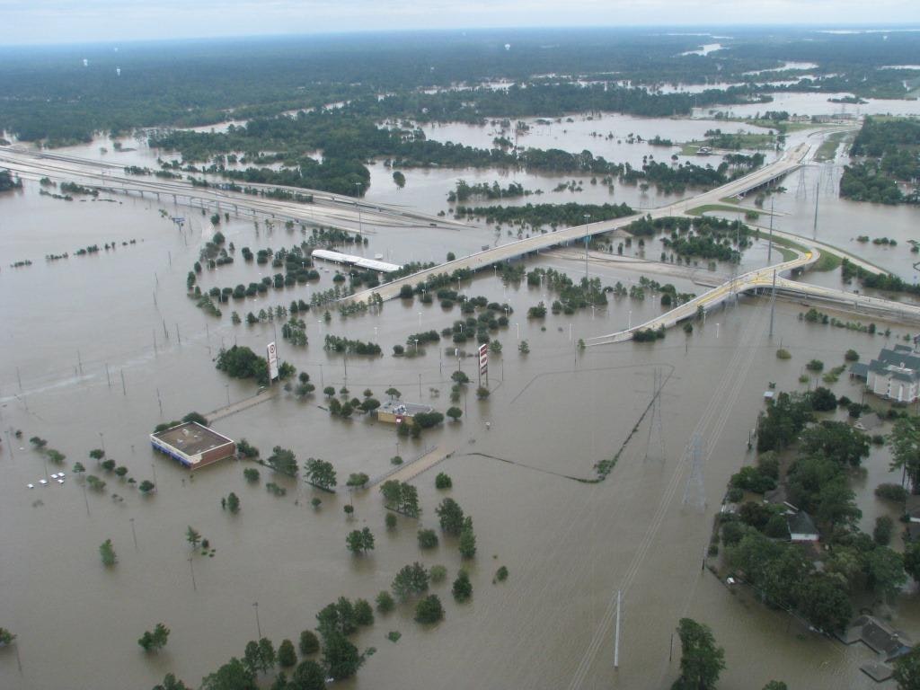
Extensive inland flooding in Texas associated with Hurricane Harvey in 2017.
Interested in Stormwater?
Get Stormwater articles, news and videos right in your inbox! Sign up now.
Stormwater + Get AlertsTens of millions of people in the United States live in areas at risk of coastal flooding, and even more are moving to the coasts every year. These growing coastal communities are at increasing risk from coastal hazards, especially with projected sea level rise.
A new interagency report, published by the U.S. Sea Level Rise and Coastal Flood Hazard Scenarios and Tools Interagency Task Force, concluded that sea level along the U.S. coastline is projected to rise an average of 10 to 12 inches in the next 30 years (2020 to 2050). This will be as much as the rise measured over the last 100 years (1920 to 2020).
Sea level rise will vary regionally along U.S. coasts due to factors such as variability in vertical land motion and sea surface height driven by ocean currents. This projected rise will create a profound shift in coastal flooding over the next 30 years by causing tide and storm surge heights to reach higher elevations and extend further inland. Higher global temperatures increase the chances of higher sea level by the end of the century.
About 2 feet of sea level rise along the U.S. coastline is increasingly likely between 2020 and 2100 due to greenhouse gas emissions to date, such as carbon dioxide, contributing to increased global temperatures. Continuation of current emissions levels could cause an additional 1.5 to 5 feet of rise for a total of 3.5 to 7 feet by the end of this century.
The report, “Global and regional sea level rise scenarios for the United States: updated mean projections and extreme water level probabilities along U.S. coastlines,” published Feb. 15, was authored by the U.S. Sea Level Rise and Coastal Flood Hazard Scenarios and Tools Interagency Task Force. The task force is co-chaired by Patrick Barnard of the USGS and includes scientists from a number of other federal agencies and academic institutions. The task force operates under the umbrella of the United States Global Change Research Program and the Subcommittee on Ocean Science and Technology.
“One of the major concerns with these new projections is the significant increase in flood frequency by 2050, including a five-fold increase in major flooding,” says Patrick Barnard, USGS research geologist and co-author of the report. “These higher water levels will also exacerbate other coastal hazards, such as coastal erosion, emerging groundwater and saltwater intrusion.”
The updated scenarios have been integrated into a new Interagency Sea Level Rise Scenario Tool that provides sea level rise information for all U.S. coastal states and territories out to the year 2150. The data conveyed in the tool and report can be accessed and downloaded by coastal practitioners and community planners to help enhance local coastal resilience.
Even gradual sea level rise can rapidly increase the frequency and severity of coastal flooding — in many parts of the United States, just 5 to 10 centimeters of rise will double flooding frequency. These new projections inform federal agencies, state and local governments, and planners and policymakers in coastal communities about current and future sea level rise which, in turn are a key component to better understand future coastal impacts at the local scale and help inform critical decisions to prepare hazard mitigation strategies in support of coastal resilience. These data will also be key inputs for the Fifth National Climate Assessment and are being incorporated into current and planned tools and services by the USGS and partnering agencies.
“Sea level rise won’t just behave like water rising in a bathtub. It will lead to more beach erosion and the loss of coastal marshes,” said Davina Passeri, a research oceanographer for the USGS in St. Petersburg. “Natural shorelines offer protection from flooding and waves during storms, while also serving as a key habitat for animals like birds and turtles. With sea level rise, we will lose that natural buffer.”
The USGS has held a critical interagency leadership position in the task force since its inception. Next steps for the task force are to begin strategizing for the next report, which is expected to have a significant focus on incorporating waves in future coastal water level projections and translating total water levels into future coastal hazards (like flooding and erosion). Given this likely new direction, data, models and tools developed across the USGS Coastal and Marine Hazards and Resources Program are expected to play an even larger role in this effort moving forward.
The main drivers for global mean sea level rise are atmospheric and ocean warming, which increase both the mass of the ocean (primarily through the melting of land ice) and the volume of the ocean (primarily through thermal expansion).