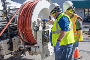
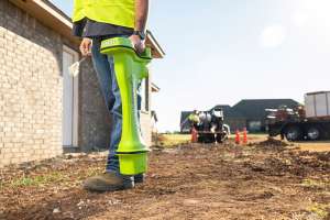
Identifying utilities through locating should be the first step on any underground construction project. Determining where water and sewer lines — and gas mains, electric and fiber cable — are located is critical for setting up a smooth job site and mitigating potential damage.
But in today’s congested and complex underground environments, simply walking the project path with a utility locator won’t cut it. These congested areas pose major pain points including issues of interference, unmarked utilities and lack of shared knowledge and data. While an individual locating technician won’t be able to eliminate all these issues on their own, there are some best practices for locating in complex ground.
Understanding interference
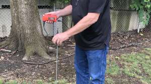
As the labyrinth of underground pipe and conduit grows — especially in urban areas — locating technicians are seeing job sites that are more complex and congested with a variety of utilities. Capable of distorting the locating signal and providing inaccurate information, interference is the most common problem locating technicians face. To determine possible interference, technicians should start by walking the job site path and visually observing previous locate markers, fences and any other infrastructure that could cause interference.
Interference can take an active or passive form. Active interference comes from sources that have their own signal and in turn can distort your target signal. This can potentially cause your signal to bleed off onto an adjacent utility, risking a mismark. Common sources of active inference include cable TV, dog fences, electrical-based irrigation systems and so on. Passive interference comes from sources without an electrical signal such as storm culverts, chain-link fences or even the rebar used in underground construction.
While not all sources of interference are visible, some manufacturers are designing equipment that will scan the job site and inform the locating technician of any potential active interference that is present in the area. One option is Ambient Interference Measurement. Technicians using a locator that has AIM on the receiver can use it to visually see which frequencies have the most or least amount of interference. As a best practice, lower frequencies like 263 Hz through 870 Hz are the best choice when encountering passive interference.
Frequency and leverage
Once possible interference has been identified, the technician must then determine the frequency of the target utility. As a best practice, you should start with the lowest possible frequency and work your way to a higher frequency. If you are using too high of a frequency — between 8.01 kHz and 44.6 kHz — you run the risk of the signal bleeding off onto an adjacent utility line. This can result in a mismark and potentially lead to a utility strike. However, if you are using too low of a frequency, you run the risk of not picking up a signal at all. When working in highly congested areas, using a locator with multiple frequencies can help technicians easily make the adjustments needed to accurately locate the correct utility.
Every job site is different and poses its own unique challenges. Going through the proper procedure of isolating a utility might sound like a no-brainer, but when technicians are challenged with time constraints due to high workload volume, they might try to find shortcuts.
One shortcut that is a major hindrance to a technician’s accuracy is sticking to a favorite frequency. Since all frequencies have the potential of bleeding off and creating a mismark, it’s important not to get into the habit of using the same frequency. This often leads to inaccurate results.
Use the data
In addition to all of the steps and best practices utility locating technicians should take when preparing for an underground construction job, leveraging the data collected after the job can help them prepare and work more efficiently on future projects.
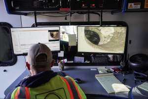
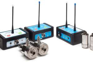
Most modern utility locating devices use automatic, real-time data capture and integrated GPS to help crews accurately and reliably locate underground utilities. The latest versions of the devices with enhanced receivers even allow a technician to locate utilities with centimeter-grade accuracy.
These devices allow technicians to map and label identified utilities in real time, and then upload the information to a mapping service. Because all data is recorded and managed digitally, rather than manually, it helps reduce the risk of errors. Planners can then more accurately estimate hours for new jobs based on historical job site data. By using technology that’s designed to work together, utility locators have the potential to streamline data sharing and access any data, when and where it’s needed, making the future of utility locating much simpler.
Continue reading for free