Researchers at The University of Texas at Austin have created a balance sheet for water across the United States — tracking total water storage in 14 of the country's major aquifers over 15 years.
The U.S. National Science Foundation-funded results were published in Environmental Research Letters, with the research examining the interplay between irrigation habits and climate on water.
"As climate-driven extreme events, particularly droughts and floods, continue to stress water systems, these findings provide important information for managing water systems across the U.S.," says Laura Lautz, a program director in NSF's Division of Earth Sciences.
The study found that irrigation can be managed more effectively in humid regions of the eastern half of the United States where surface water is more readily available, a finding that could have implications for where the country can grow food, according to the researchers. With longer-term droughts and intermittent intense flooding expected in the future, particularly in the arid western United States, there is rising concern about overtaxing water resources in the region, especially for irrigated agriculture.
"It is important to understand the relationship between human water use and climate extremes to develop more sustainable water management practices," says the study's lead author, Bridget Scanlon.
The study also shows that surface water plays an important role in replenishing groundwater, helping dampen the impacts of irrigation.
For instance, groundwater pumping for irrigation in the Mississippi Embayment aquifer system exceeded that of the California Central Valley, one of the most productive agricultural areas in the world. But satellite data showed that the Mississippi Embayment did not experience long-term groundwater depletion despite the high levels of pumping. Researchers attributed this to groundwater pumping capturing water from the dense stream network in the humid Mississippi Embayment.
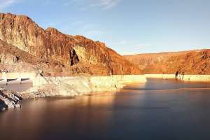
In contrast, in the semiarid western U.S. where droughts are much more prevalent, irrigation can amplify or dampen drought impacts depending on the source of irrigation water. For example, in the California Central Valley, irrigation switches from mostly surface water during wet periods to predominantly groundwater during droughts, amplifying the impacts of drought on groundwater depletion. That has led to groundwater depletion in the Central Valley totaling about 30 cubic kilometers — similar to the storage capacity of Lake Mead, the largest surface water reservoir in the United States.
Continue reading for free