We’re working to present a unified voice to Washington for the benefit of the industry.
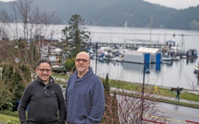
The town of Gibson has changed the rules by placing natural assets on the same footing as built infrastructure
Capacity, Management, Operations and Maintenance programs help collections system operators identify where the system and organization are thriving and what areas need improvement
You have to have a clear picture of your assets and a plan for effective renewal
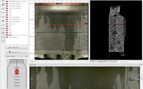
WinCan's Manholes Module allows users to analyze, annotate, report and share their manhole inspection data
Kansas City’s water utility hit a peak of 1,844 water main breaks in 2012. Today it has a much better handle on its aging infrastructure.
With the increasing need for precise mapping, municipalities are deploying geospatial probes to achieve real-time position tracking in order to create virtual 3-D computer models of underground assets
At the No-Dig Show, municipalities and engineers discuss different ways utilities can start assessing their water and sewer systems in order to prioritize future work
Asset management system ties old and new together in a comprehensive web-based platform.
Developing a strategic plan helped struggling water district find focus, stabilize operations and improve service.