Leaks from drinking water systems cost money. So do leak detection and repair programs.
The trick to dealing with leaks is to find the method that delivers the best possible return on investment. A variety of leak detection tools and methods are deployed with success at water utilities of many sizes. Now, Utilis adds a new layer of technology that can help make those tools more cost-effective to deploy.
The company has devised a method for detecting leaks in water distribution and transmission networks from outer space. The technology is based on analysis of images captured by a satellite-mounted radar system and sensor. The company says its method, used in tandem with traditional acoustic devices, can triple leak detection efficiency.
The technology requires no upfront investment in equipment and can significantly reduce field labor. It enables priority leaks to be targeted and addressed quickly. Utilis CEO Elly Perets talked about the technology in an interview with Municipal Sewer & Water.
MSW: What is the history behind this technology?
Perets: Utilis was founded in 2013 and has been operational for the last three years. The idea came from our chief technology officer and founder Lauren Guy, who was studying for his master’s degree in atmospheric physics and dynamics and was using remote sensing to find underground water on Mars and Venus. Since we have so many water-related problems right here on Earth, he decided to apply that same technology to help find underground water here.
MSW: What is the practical benefit of the Utilis technology?
Perets: Our solution helps utilities reduce nonrevenue water. It can pinpoint as many as hundreds of possible leaks in a single project, and it can be much more time- and cost-effective than traditional leak detection methods.
MSW: How does this technology save time and money over acoustic listening and other conventional methods?
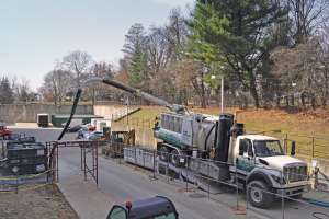
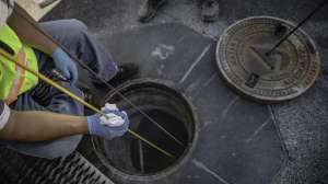
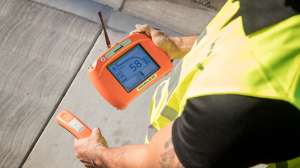
Perets: First of all, satellite leak detection methodology does not substitute for traditional acoustical leak detection. Depending on the size of the distribution system, we deliver to our clients dozens or hundreds of possible leaks that may be happening in the system. So instead of an acoustic leak detection team going through the entire system, walking 2 1/2 to 3 miles a day, they simply go to specific points that we’ve delivered, saving time and money.
MSW: In basic terms, how does the satellite-based technology work?
Perets: The satellite orbits about 400 miles above the surface. It carries a radar that sends microwaves to Earth in a specific wavelength and frequency that can penetrate the ground. Every single object reacts to microwaves and sends back a signature that is received by a sensor. We look for the signature of treated water that is gushing out of a pipe and in contact with soil, thus creating chemical reactions. That is what the satellite picks up.
MSW: How is all this data sorted and analyzed?
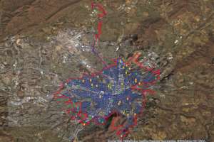
Perets: Once we have an image formed, we do many things. We do georeferencing and we clean out many types of noise, because the satellite image picks up not only water but also vegetation, buildings and man-made objects in general. The last part of process is to input that image into an algorithm that we developed. We pick up all types of water: treated water, high water tables, sewage and seawater. We filter out everything that is not treated water in contact with soil and deliver the finished image to the client.
MSW: Can the technology differentiate large leaks from small leaks so that utilities can set repair priorities?
Perets: We pick up leaks as small as 0.1 liter per minute (0.026 gpm), but our reports do not distinguish between small, medium, and large leaks. We deliver to the client a GIS map with a grid code where we identify the leaks according to probability: red is the highest, then yellow, then green, and then blue is the lowest probability. The color indicates how strongly we picked up the signal of treated water in contact with soil, but that doesn’t indicate the size of the leak. A big leak running for two days can give the same signal as a very small leak running for three years. However, because our map shows the areas of highest probability, customers can attack those areas with the expectation of finding most of the leaks there.
MSW: What kind of orbital pattern does the satellite follow?
Perets: The satellite orbits the planet in a polar orbit about two dozen times every day. It covers the same swath of the Earth every two weeks. So if we took one image of New York City today, the next time we could get one covering an identical swath of area is two weeks later. One satellite frame can give us a 50- by 70-kilometer image, which is 3,500 square kilometers, or 1,200 square miles.
MSW: Once you contract with a utility to do this, how is the offering structured?
Perets: It differs for every customer and the price is based on the length of pipeline they want to monitor. We do provide single surveys, but most customers need a service contract, as leak detection is an ongoing issue.
MSW: How would you characterize the customer response so far?
Perets: Customers like it because we pinpoint not just leaks that have surfaced, but also background leaks — those that most likely wouldn’t be found without our tool. Some leaks are in locations where acoustic listening is difficult or come from plastic pipes. Normally, we can deliver many more leaks and do so much faster than acoustic leak detection. We have served more than 100 utilities in 26 countries. We do not have to prove anymore that our technology works. It has already become part of the utility toolbox.
Continue reading for free