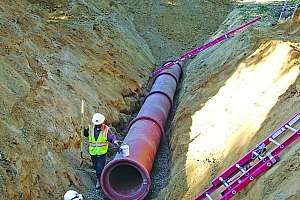
Problem: The City of Starkville, Miss., needed to quickly get a handle on blockage conditions within its 171 miles of gravity-fed sewer as part of an EPA Agreed Order on Consent (AOC) to reduce SSOs.
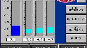
Solution: The city chose the Sewer Line Rapid Assessment Tool, or SL-RAT, from InfoSense, to help focus cleaning efforts around hot spot areas that had experienced SSOs or slow sewers. The unit is composed of a transmitter and a receiver. The transmitter is placed in an open manhole and transmits a sequence of tones through the air gap within the pipe. The receiver is placed in an adjacent manhole and listens for degradation in the tones it hears compared to the tones it should hear in a clean pipe. It exploits the fact that sound and water flow similarly through the free space within a pipe. The algorithms are able to quickly analyze the result and present the operator with a simple blockage assessment in real time on a scale of zero to 10. Measurements can be conducted in three minutes or less with no flow contact, no confined-space entry and a low cost.
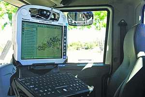
Problem: Jetting crews working in Thousand Oaks, Calif., clean over 400 miles of pipeline each year. Paper maps were being utilized in the jetting trucks to track the progress of this scheduled maintenance. However, rolling out a paper map and using a highlighter to make changes was not efficient. The city sought new software that would decrease paperwork along with overtime and increase efficiency.
Solution: Since infraMAP software from iWater was already in use by the water department, the wastewater supervisor consulted with them and learned how to use it to improve productivity. The city also wanted the new software to include a function that talked directly to its Esri GIS environment.
Continue reading for free