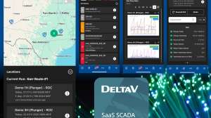
The cloud-based t4 Spatial platform makes hard-to-access information instantly available on any device, through an intuitive geospatial interface. Integrated data from PACP inspection videos, GIS, sensors, systems and services becomes a powerful tool for maintenance and management. The platform’s advanced analytics enable work plans across all assets and improve regulatory compliance. Mitigate risks by knowing when, where, how and why to clean, inspect and remediate. The platform reduces maintenance costs, improves operations and fosters interdepartmental collaboration, all with no capital expenses. 805/921-3000; www.t4spatial.com.