Filed Under
Sign Me Up!
Sign up Digital!
Subscribe to Print!
Interested in Infrastructure?
Get Infrastructure articles, news and videos right in your inbox! Sign up now.
Infrastructure + Get AlertsInspecting miles of flood control waterways, reservoirs and other infrastructure is getting a lot easier thanks to new technology. The use of remotely piloted vehicles, especially drones, is increasing quickly as prices come down and operating them is simplified by connecting them to smartphones, tablets and laptop computers.
In Denver, Public Works senior engineer Kevin Lewis says he’s used his drone a lot since it was acquired in March and can accomplish in a few minutes what used to take hours, and do it safer. Don Nuelle, lead civil engineer in the Infrastructure Maintenance Division, says his South Florida Water Management District has been using remotely operated subs for about 15 years. Four of the five district offices have one and use them regularly to inspect water control structures.
“Access to our flood control facilities is pretty limited on foot; large ponds, rivers, creeks, gulches, inlet and outlet structures, and channel banks,” Lewis says. “There are places we can’t get to very easily or safely. So we use the flying camera to do it for us, and I can safely get within 5 feet from a half mile away.”
From the Air
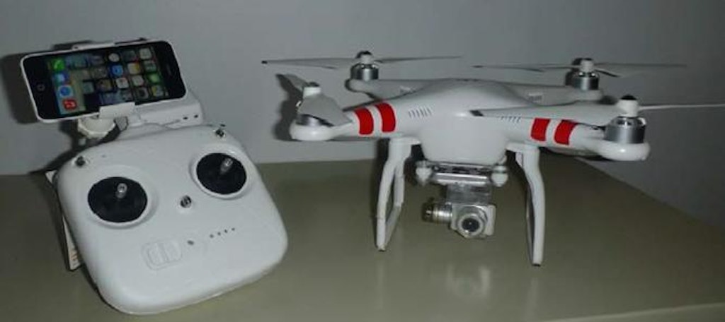
Lewis has a 2.7-pound Phantom 2 Vision+ Quadcopter from DJI. The camera shoots 1080p high-definition video and 14-megapixel still photos that are stored on an onboard 4-gigabyte SD card and broadcasts a live feed back to his iPad.
“The clarity is just incredible,” he says. “It gets you perspectives and angles that are just impossible to get any other way.”
Flight radar on the control unit displays the position of the drone; loss of signal or exceeding the range will prompt the drone to automatically return to the point where it took off using GPS positioning. GPS also allows the drone to maintain a set position, even in windy conditions, so Lewis can concentrate on controlling the camera to get the shots he wants. It can also be preprogrammed to follow an assigned flight path. Total flight time is about 25 minutes.
In June, Lewis demonstrated the drone for local media by inspecting the Kelly Road Dam that has a 10-acre wetlands pond, inlet and outlet structures, a spillway for flood control, and a berm surrounding the entire area, which is a half mile wide and three-fourths of a mile long.
“I can do a full facility inspection standing in one place in 15 to 20 minutes,” he says. “It would normally take up to 90 minutes to cover that ground. Not to mention the safety, trudging around in waders through 4 or 5 feet of water.”
It doesn’t take long to recoup the investment of $2,500, which included the drone, camera and software, carrying case, three extra batteries and a few accessories. Lewis can easily edit the video, add some captions and upload it to the Internet. “That’s incredibly powerful, to be able to share that data with your whole team,” he says. “I can show it to people around the world, if necessary.”
Every year, Denver Public Works inspects stormwater outfalls for erosion along miles of creek and river banks. “The only way to get the right vantage point is from the river. You can’t stand on the bank and look down because you can’t see anything,” Lewis says. “You can’t look from the other side because it could be 150 yards across, and they are typically covered by vegetation. I can take the drone and run it right down the bank, take video the whole way, and bring it back to my desk to see everything I need to see.”
Lewis has also found an unexpected use — inspecting runoff controls at construction sites. “We found the drone to be helpful on large sites, especially those that are 20 or 30 acres. I’ve gone out and done video and pictures of the key erosion control items, brought them back and shared them with our inspectors. It’s been very helpful to them.”
Under Water
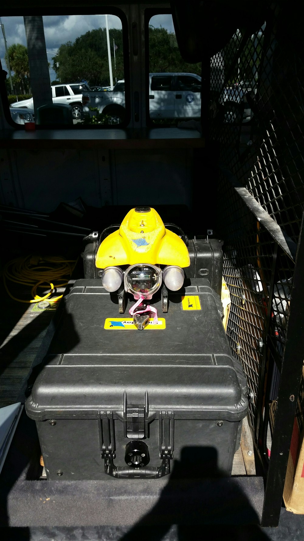
The South Florida Water Management District has various models of the VideoRay line of remotely operated vehicles. They are small submarine units, about 16 inches long, 8 inches high and 8 inches wide. Nuelle has the latest model in his truck, a VideoRay J10100.
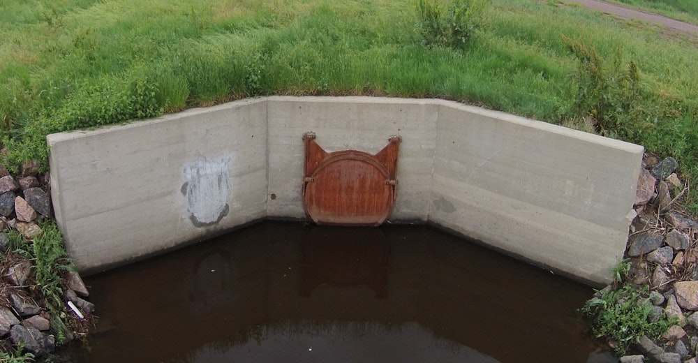
The ROVs are used about twice a month for inspecting the regional water management system that serves 8.1 million people across 16 counties. That includes 2,100 miles of canals, 2,000 miles of levees and berms, 70 pump stations, more than 600 water control structures, and 625 project culverts.
The ROVs cost around $35,000 each, but pay for themselves due to the specialized applications. “A lot more things can go wrong underwater, and electronics and water just don’t mix,” says Nuelle.
Sending in a dive team, which includes up to five people — a supervisor, two divers and a tender for each diver — can cost around $3,000 a day. “The ROV allows us to send out two guys and do an inspection,” he says. “The ROV can often deduce the problem and specify a fix without spending the time and expense to schedule the divers to go look at it.”
The ROV is also quicker and safer. “I can be out there in an hour. It might take several days to get the dive crew out there. And diving can be fairly dangerous.”
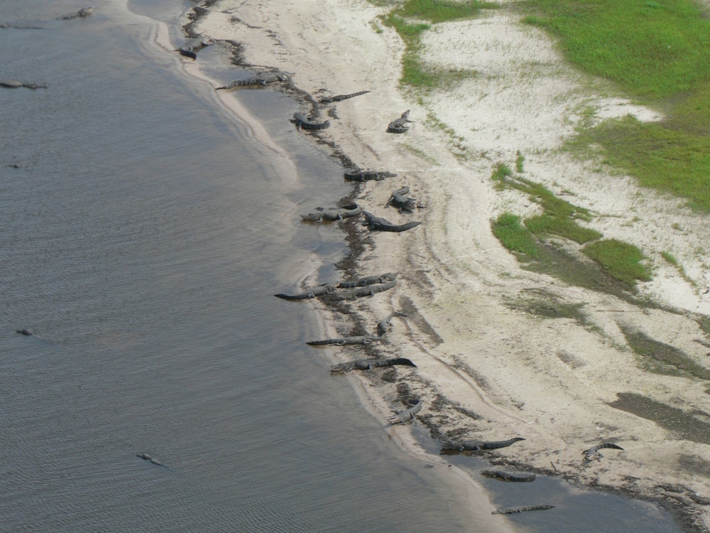
Not only are there the risks inherent with working underwater, any time Nuelle puts people in the water, he has to hire an alligator trapper at $500 a day. “I’ve had big alligators chase after the ROV and had to pull it in real fast.”
The unit has high-definition cameras on the front and back along with lights for illumination. The cameras swivel up and down, but do not pan side to side. Video and pictures are stored directly on a laptop through a 300-foot umbilical line. It can also be outfitted with a remote-operated manipulator arm that can retrieve small parts, like nuts and bolts, and pick up samples. He has found it handy for checking seals on gates. “We’ll grab a piece of colored tape and stick the arm against the gate. We can see if it is leaking because the tape will flutter.”
Nothing Simple
Despite years of experience, Nuelle says he’s still learning how to pilot the craft. “There are two types of people who operate ROVs: those who have gotten theirs stuck and those who haven’t got it stuck yet. We’re operating in water that basically has zero visibility and are often bumping into things and going in the wrong direction. I have had to call out a dive crew once to rescue my ROV.”
Operating under limited visibility, the ROV is often guided using a compass heading and depth. Nuelle normally runs it on the surface until it gets near the location that is being inspected, then submerges to conduct the inspection.
“We bought a sonar unit that can be attached to try to identify objects far way,” says Nuelle. “We use the sonar to show us an obvious shape, like an entrance to a culvert, then head in that direction until we can see it.”
Piloting one of the new aerial drones is more difficult than it may appear, as many amateur drone owners who have lost or crashed their units will attest. “I’ve never lost it,” says Lewis. “I’ve landed it hard a couple of times, tipped it over, and a cracked a propeller once.”
Lewis first learned to fly his drone with flight simulator software purchased from the manufacturer that uses the drone’s remote control device. “I did that for about two weeks before I took it out to fly; that was very helpful.”
Then he spent several hours practicing. “I had to get really good and confident before I was going to do what we needed to do. I just went to a park and spent about an hour for three or four days putting it through basic maneuvers, getting a sense of it, and getting a feel for how stable it is, what I can do and can’t do. It was three weeks before I felt comfortable enough to take it out.”
Since they’re so new, regulations concerning drone use are evolving. “There are some things you can’t do now, like fly within 5 miles of an airport or higher than 400 feet,” says Lewis.
The Federal Aviation Administration has drafted new regulations because some drones are large fix-winged aircraft that can fly for hundreds of miles and pose a risk to aviation. The rules, out for comment now, and are expected to take effect in the fall 2016.