I drove to Colorado recently.
Northern Wisconsin was frozen and snow covered when I left. Vehicles were parked on lakes where people were ice fishing. People think of Wisconsin as wall-to-wall dairy farms, but the reality is far different. The northern half of the state is heavily wooded and includes one of the highest concentrations of freshwater lakes in the world.
In winter, we don’t see bare ground at the top of the state for many months. The snowpack lessened, however, as I made my way south, crossing the Wisconsin River eight times. Forests gave way to farm country, flat ground to the hills and bluffs of unglaciated southwestern Wisconsin and across the Mighty Mississippi in eastern Iowa. And then things really flattened out as giant windmills rose up from the unbroken expanses of the plains.
Eventually we crossed the Missouri River into Omaha, and soon after, the North Platte. The vast majority of the state sits above the Ogallala Aquifer. Ditches and waterholes dotted the landscape as we moved west but gave no indication of the vast water resources beneath the tilled surface of the Cornhusker State.
“How did the states get mapped out?” my sister asked, breaking a silence that seemed to emanate from the vast, treeless landscape.
I answered, offering a vague list of factors that likely had influence in any given case. The answer, however supposed, seemed to suffice.
But it got me thinking about those early days, the people who regularly dealt with conditions and hardships most of us would find insurmountable, to move their families and few belongings West in covered wagons.
Almost as if on cue, another question came from the back seat. “How many miles could covered wagons travel in a day?”
Ten to 20 miles. Google answered that one.
At that point we’d traveled about 700 miles since morning and the fact that it might have taken the early settlers two months to cover that stretch was almost impossible to comprehend. As open and endless as that stretch of western Nebraska and eastern Colorado feels at 80 mph, imagine rattling down the trail at 10 mph in search of a place you’ve never seen.
Water played a big role in guiding settlers and shaping boundaries. The eastern side of the Louisiana Territory was bordered by the Mississippi River, from its headwaters to the Gulf. The Sabine, Red and Arkansas rivers formed much of its western boundary. The Missouri separates Iowa and Nebraska. All but six states have some portion of a border shaped by a river.
Water still defines borders, but it’s important that we not let it create boundaries between prosperity and struggle. Those early settlers were mostly in search of land to farm, but access to water played just as big a role in where they ended up.
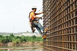
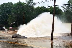
Today, we don’t have to live near a lake, river or stream to have access to freshwater. Municipal infrastructure reaches far beyond the banks of the closest river. But just as demand on the Colorado has it stretched thin, so too do the demands on your utilities — population growth, droughts, inadequate budgets — make it increasingly challenging to meet the needs of your communities.
We have resources and capabilities our forebears never could have imagined. Water flows freely from our taps. It wasn’t always that way, and it won’t always be without the protection of our resources and the support of our infrastructure. We should all demand that.
Here’s hoping we all find the prosperity we’re searching for at the end of the trail.
Enjoy this month’s issue.
Continue reading for free