For municipalities and contractors tasked with managing buried infrastructure, the ability to accurately locate and map underground utilities is paramount.These tools showcase advanced approaches in pipeline surveying and mapping, offering sophisticated solutions that combine multiple functions into single, streamlined devices. By integrating advanced signal detection, ground-penetrating radar and high-precision global navigation systems, these technologies allow professionals to work more efficiently, reduce the risk of accidental damage and create detailed, accurate records of what lies beneath the surface. Take a look at some product options below.
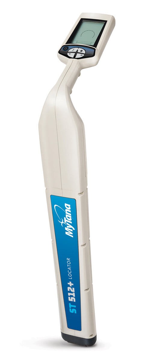
MyTana MT 512+ Locator
Accurate and easy to use, the MT 512+ Locator from MyTana is designed for sewer and drain contractors to pinpoint the location of 512 Hz signal transmission in all pipes, with the capability to detect many other frequencies. A large, high-contrast LCD display clearly shows signal response in bright sunshine or shadows and displays real time data including continuous depth, signal strength and directional arrows that guide you to the target location. Audio response supplements the visual data. It is powered by a long-lasting, rechargeable lithium-ion battery. Alone, it not only detects 512 Hz signal from all MyTana cameras as well as other sondes, but also 640 Hz, 815 Hz, 8 kHz and 33 kHz signals. Partner with MyTana’s LineFinder Transmitter to expand the frequency range and pinpoint the location of buried utilities. It lets you take advantage of seven line-tracing modes in addition to sonde mode. 866-948-7576; www.mytana.com
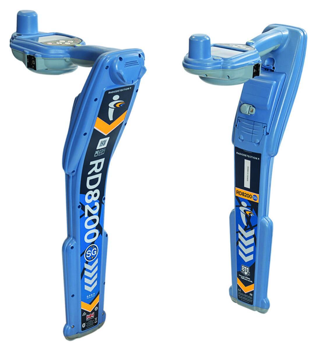
Radiodetection RD8200SG
Locate and map buried utilities in a single operation with Radiodetection’s RD8200SG survey-grade precision locator. Equipped with an integrated GNSS antenna, users can simultaneously view and build maps with survey-grade accuracy on a mobile phone while locating. It is a turnkey solution for those new to utility mapping, while utility mapping experts can connect into advanced systems. It excels in locating buried utilities, with features such as technology that rejects strong interfering signals, current direction to identify targets among a number of parallel utilities, and StrikeAlert to warn of shallow cables, reducing the risk of accidents or damage to buried infrastructure. An ergonomic, lightweight design ensures comfort during extended use, while automatic usage logging and swing warnings promote proper handling and enhance safety. 877-247-3797; www.radiodetection.com
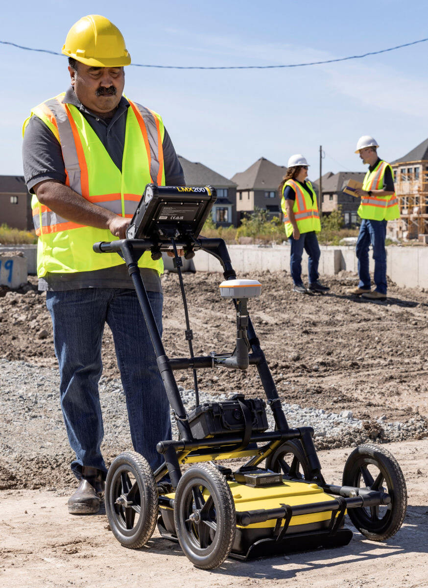
Sensors & Software LMX200-SG
The LMX200-SG (Survey Grade) from Sensors & Software integrates the LMX200 GPR system with a plug-and-play GNSS accessory for accurate positioning in utility mapping applications. It detects and maps metallic and nonmetallic utilities, underground tanks and no-utility structures. The system includes a preconfigured Juniper Geode GNSS receiver offering 30 cm RMS accuracy (with SBAS). The RTK upgrade enables 20 cm RMS (with Galileo HAS) or 1 cm RMS (with RTK corrections, not included). GNSS data is logged at 10 Hz and fully integrated with GPR data, simplifying field collection and post-processing. Power is supplied from the GPR system battery, eliminating the need for separate GNSS battery management. It is compatible with EKKO_Project software for data analysis and export. 800-267-6013; www.sensoft.ca
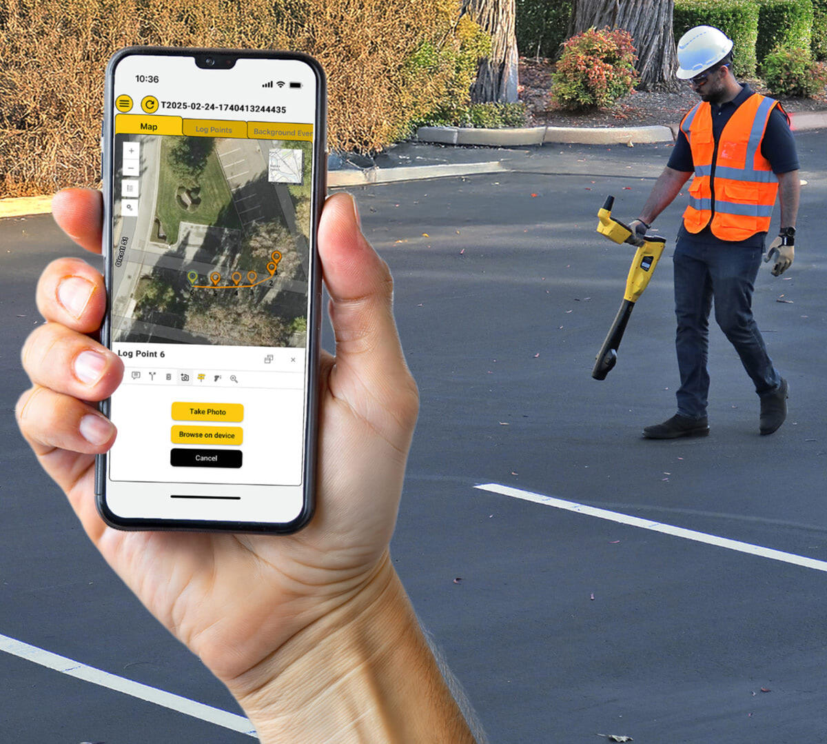
Vivax-Metrotech vLoc3 RTK-Pro
Utility technicians often rely on multiple devices (GNSS receivers, data loggers, radios) to gather and transmit accurate location data. This setup can slow down fieldwork, increase training time and complicate data handling. The vLoc3 RTK-Pro locating and mapping system from Vivax-Metrotech simplifies the process by combining high-accuracy electromagnetic locating with built-in RTK GNSS and direct cellular connectivity to the free cloud. In real-world scenarios, technicians use it to locate buried utilities and automatically upload precise data in real time — no external equipment or manual transfers required. It offers EM locating, RTK GNSS, Bluetooth and cellular in one device. 408-734-3880; www.vivax-metrotech.com
Continue reading for free