Extensive modeling for the Lake Mendota watershed in Dane County, Wis., revealed that 500 to 600 acres per year of urban development contributed 23 percent of all sediment and 20 percent of all phosphorus entering the lake. That acreage represents just 0.3 percent of the lake’s watershed.
The five lakes in the chain in and around Madison, the state capital, are the county’s crown jewels. However, sediment from runoff can cloud the water and fill in spaces around residential boat docks and piers. Phosphorus nutrients proliferate weeds and algae blooms, which consume dissolved oxygen, giving the water a foul odor.
County leaders and Jeremy Balousek, P.E., urban conservation engineer for the Department of Land and Water Resources, knew that effective erosion and stormwater control would have a major effect on the pollutants entering the Madison Chain. They focused on a plan for Lake Mendota, the largest of the group.
From the Lake Mendota Priority Watershed Plan, the county adopted a performance-based erosion and stormwater ordinance that set standards limiting the amount of sediment, oil, and grease runoff from urban developments, and specifying the temperature of stormwater runoff.
The program became the model for Wisconsin legislators and many communities across the country. In 2002, the program received the Minnesota Erosion Control Association Stormwater and Erosion Control Achievement award.
Science-based standards
The shorelines of lakes Mendota and Monona define the isthmus on which the City of Madison is built. Mendota, covering 9,842 acres, has a maximum depth of 82 feet, and its watershed encompasses 217 square miles.
While most counties have jurisdiction only in unincorporated areas or townships, Dane County took erosion and stormwater jurisdiction over the entire county. The main reason for that was to level the playing field.
“Before we enacted the ordinance, communities played off each other’s stormwater requirements,” says Balousek. “Those with fewer restrictions had a better chance of attracting contractors.”
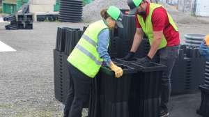
Science-based standards for erosion control drive the county’s program. Those standards set soil loss at a maximum of 7.5 tons per acre. “Developers must model the potential erosion that will leave their site and prove their construction will not exceed the standards,” says Balousek. “Our standards require contractors to remove 80 percent of all sediment, and to treat the first half-inch of runoff for oil and grease through filtration.”
The county does not specify which practices contractors must use to control runoff quality, peak flow, and water quality. Instead, an erosion and stormwater management manual on the county Web site provides guidance.
“How they do it is up to them,” says Balousek. “We avoid the conventional cookie-cutter approach because one solution doesn’t fit every application, especially when the goals are infiltration and runoff volume control.”
Studies show that the lakes are improving. According to the University of Wisconsin Center for Limnology, the water quality in the middle of Lake Mendota is very good. However, an interesting phenomenon is occurring.
The Madison Chain was a seepage system, fed by groundwater. Because the Madison area pumps groundwater for drinking water, the water in Lake Mendota is flowing backward into the aquifer. However, the risk of the lake drying up is nonexistent. “The base flow of the streams entering Mendota beyond the metropolitan area will prevent that from happening,” says Balousek.
Thermal pollution
The stormwater program addresses more than just the lakes. Half the county has small, cold-water trout streams. Runoff from storms can elevate water temperatures in those streams, stressing or killing the fish and damaging the sensitive ecosystems. Therefore, the county stormwater ordinance sets temperature standards for runoff to reduce thermal pollution.
“We require developers to model the impact of the runoff temperature to the streams,” says Balousek. “If it’s elevated, then they must implement practices to reduce the temperature.” The primary tool for that purpose is infiltration, via rain gardens, bioretention basins, and underground dispersal. “We don’t want wet stormwater ponds because the sun super-heats the water,” says Balousek. “Rainstorms then displace it to the streams.”
Ambient soil temperatures set stream temperatures. Since the trout streams average 58 degrees F, the temperature of the soil 2 feet below grade, the county adopted that temperature for its standard.
Bioretention basins are 10- to 12-foot-deep excavations filled with sand and topped with 3 feet each of clear stone and engineered soil, a mix of compost, sand, and a little topsoil. The compost removes heavy metals, oil and grease. All told, the basins remove more than 90 percent of sediment in runoff and cool the water.
The county plants native prairie plants in the bioretention basins because their deep roots retain more runoff than turf grass. “However, the basins are dry until it rains, so our list of prairie plants that withstand dry and wet conditions is very narrow,” says Balousek. An underdrain system prevents the plants from drowning during wet periods.
Breaking the chain
Connected impervious areas drive runoff temperatures, so the county’s strategy is to disconnect them. For example, draining a roof onto a lawn instead of a parking lot not only keeps the water clean, but also cool. Besides natural porous structures, contractors also are using more porous asphalt, concrete, and paving blocks.
A constant concern is that the freeze-thaw cycle in the area’s cold climate blows out chunks of pavement each spring. To avoid potholes in porous asphalt, Balousek designs parking lots with a thick stone storage layer beneath them. Water ponds in the stone to a certain depth, then flows into drain tile systems, eliminating blowouts.
As part of its strategy to disconnect impervious areas, the county also replaces conventional curbs with ribbon curbs that drain the sheet flow into boulevards sunken 6 to 12 inches deep, or into roadside channels. “The boulevards may not have an outlet until the water ponds to 6 inches, allowing for infiltration,” says Balousek.
Such practices enabled Dane County to surpass the state’s 2013 discharge limit of 40 percent TSS removal by 1 percent. Another contributing factor is its grant program. Dane shares county money with municipalities to install sediment-control devices in developments built before the 1970s. “It’s a very successful program,” says Balousek.
Sediment basins, the best sediment-control device, store water long enough for soil particles to fall out of suspension. Unlike detention ponds, the basins restrict flows during normal rainfalls, but release water during major storms. When land is unavailable for sediment basins, the county looks at underground proprietary devices from Baysaver Technologies Inc. (Advanced Drainage Systems Inc.), Storm-Tech LLC, and CONTECH Construction Products Inc.
Looking ahead
To identify critical sites for erosion and stormwater controls, the county is conducting innovative modeling projects, such as quantifying and locating hot spots for phosphorus loading to the Lake Mendota watershed. Studies include farm animal counts, tillage practices, surveys of crops grown, and land-use surveys.
“Rather than do these studies in all the tributaries entering the lake system, we’re hoping we can transfer the modeling information to them,” says Balousek. “We ultimately want to model farmland and urban areas throughout the Madison Chain to identify critical sites we can target for controls.”
The county also is buying and restoring drained wetlands to provide flood storage for the lakes. During the state’s agricultural period, farmers drained 90 percent of the county’s wetlands. “We target $2.25 million per year to buy wetlands,” says Balousek. “Since the property is undesirable for development, we can purchase hundreds of acres.”
Because Dane is one of the state’s fastest growing counties, Balousek sees volume control as the next decade’s biggest challenge. One strategy already in place is narrowing streets, the largest impervious areas in residential developments. Some roads are 48 feet wide, the width of interstate highways. While many municipalities have narrowed their streets to 32 feet, Balousek wants 28-foot-wide roads where feasible. He sees eliminating parking on one side as an option.
Retrofitting stormwater ponds to provide flood control and act as sediment basins is another strategy. By excavating the facilities, the county increases their volume and establishes permanent water for sediment storage. Workers also restrict the size of outlets to detain smaller storms.
Dane County continues to look beyond conventional practices to address its erosion and stormwater management issues. Balousek and his team treat every development site individually, designing better practices, better infiltration techniques, and better ways to limit runoff for now and far into the future.
Continue reading for free