Electronic Line Locators
MyTana MT 512+ Locator
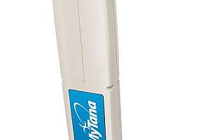
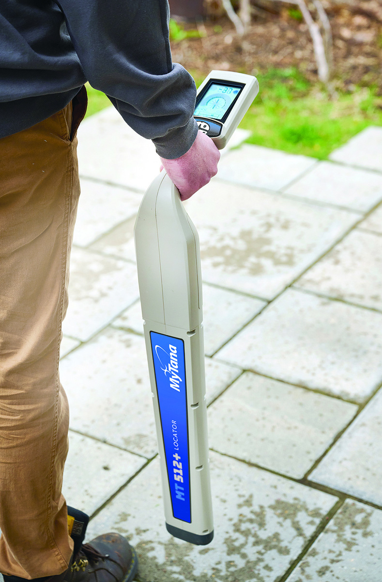
Accurate and easy to use, the MT 512+ Locator from MyTana will meet the demands of any locate task. It’s designed for sewer and drain contractors to pinpoint the location of 512 Hz signal transmission in all pipes with the capability to detect many other frequencies. A large, high-contrast LCD display clearly shows signal response in bright sunshine or shadows, and displays real-time data including continuous depth, signal strength and directional arrows which guide you to the target location. Audio response supplements the visual data. It is powered by a long-lasting, rechargeable lithium-ion battery. Alone, it not only detects 512 Hz signal from all MyTana cameras as well as other sondes, but also 640 Hz, 815 Hz, 8 kHz and 33 kHz signals. It can be partnered with a line transmitter to expand the frequency range and pinpoint the location of buried utilities. 877-833-2343; www.mytana.com
Radiodetection RD8200SG
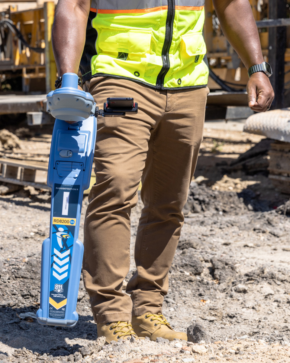
Locate and map buried utilities in a single operation with Radiodetection’s RD8200SG survey-grade precision locator. With an integrated GNSS antenna, users can view and build high-accuracy maps on a mobile phone while locating. It is designed to support accurate utility locating, with features such as interference rejection, Current Direction to help differentiate targets among parallel utilities, and StrikeAlert to warn of shallow cables, thereby helping reduce the risk of accidents or damage to buried infrastructure. An ergonomic, lightweight design helps ensure comfort during extended use while automatic usage logging and swing warnings help promote proper handling and enhance safety. When used with Locate Performance Management, the comprehensive digital solution helps utility owners track and manage locate operations, with tools that support locate quality assurance and validated mapping, as part of a proactive damage prevention program. Upcoming enhancements will introduce an updated display with a richer visual interface and intuitive menu structure. 877-247-3797; www.radiodetection.com
I&I Detection

CUES LAMP II
Locate buried assets and help prevent potential crossbore risks and with the CUES LAMP II. It is an inspection tool for identifying I&I, potential crossbores, pipe defects and structural conditions in lateral services and mainlines. The LAMP II with the optional Mini or Micro Pan & Tilt Cameras can inspect lateral services and traverse multiple bends and wyes when deployed with or against the flow. Mainline inspection is accomplished with a pan, tilt and 40-1 zoom camera. It can pull 1,000 feet of video cable, reducing traffic control expenses while increasing production, and launch 150 feet or more into the lateral. The Mini Pan & Tilt Camera includes a detachable steering wand, self-leveling camera head, built-in lens wiper, 360-degree pan-and-tilt, four banks of LEDs with variable light intensity and a built-in sonde with switchable frequencies. 800-327-7791; www.cuesinc.com
Laser Profiling Equipment

RedZone Robotics Profiler3D
Profiler3D from RedZone Robotics is built on sensor fusion, integrating multiple technologies to capture a complete and accurate representation of large-diameter underground assets. LiDAR and structured light systems generate high-density geometric data, capturing millions of measurement points that define pipe shape and structure. This allows engineers to identify deformation, ovality and subtle changes that would be missed in traditional inspections. To address submerged conditions, sonar is integrated into the system. Acoustic pulses map the pipe below the waterline, capturing inverted conditions, sediment buildup and hidden defects. This ensures full cross-sectional coverage, eliminating one of the most common gaps in inspection data. HD video provides critical visual context, showing material conditions and environmental factors. Through photogrammetry, this visual data becomes measurable, enabling the creation of detailed 3D models and digital twins. 412-476-8980; www.redzone.com
Pipeline Leak Detection
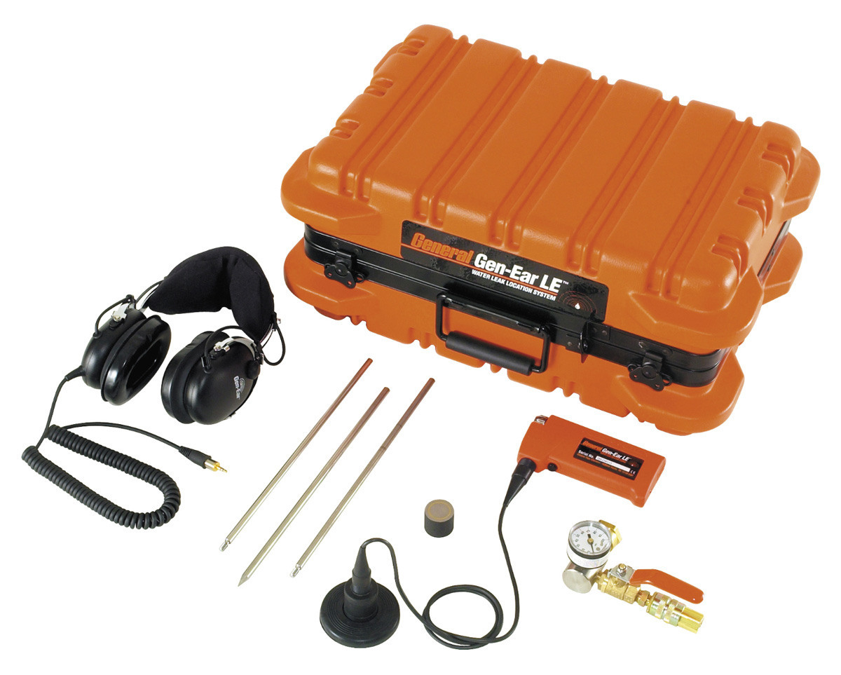
General Pipe Cleaners Gen-Ear LE
The Gen-Ear LE from General Pipe Cleaners is an easy-to-use, economical water leak locator with stronger sound amplification than other systems. It can be used to pinpoint water leaks in residential and commercial waterlines. The compact amplifier fits easily in the palm of your hand. It provides noise-free amplification with built-in preset audio filters so you don’t have to guess what settings to use. High-performance headphones with noise cancellation blockout interference from surrounding ambient noise. The advanced acoustic sensor listens for the gurgling or hammering of water escaping from a cracked pipe under any surface, like concrete, tile, grass or carpet. For especially hard to find leaks, the Sound Amplification Module adds air to the line, increasing the water pressure, thus amplifying the leak sounds, making them easier to locate. 800-245-6200; www.drainbrain.com
Pipeline Surveying/Mapping
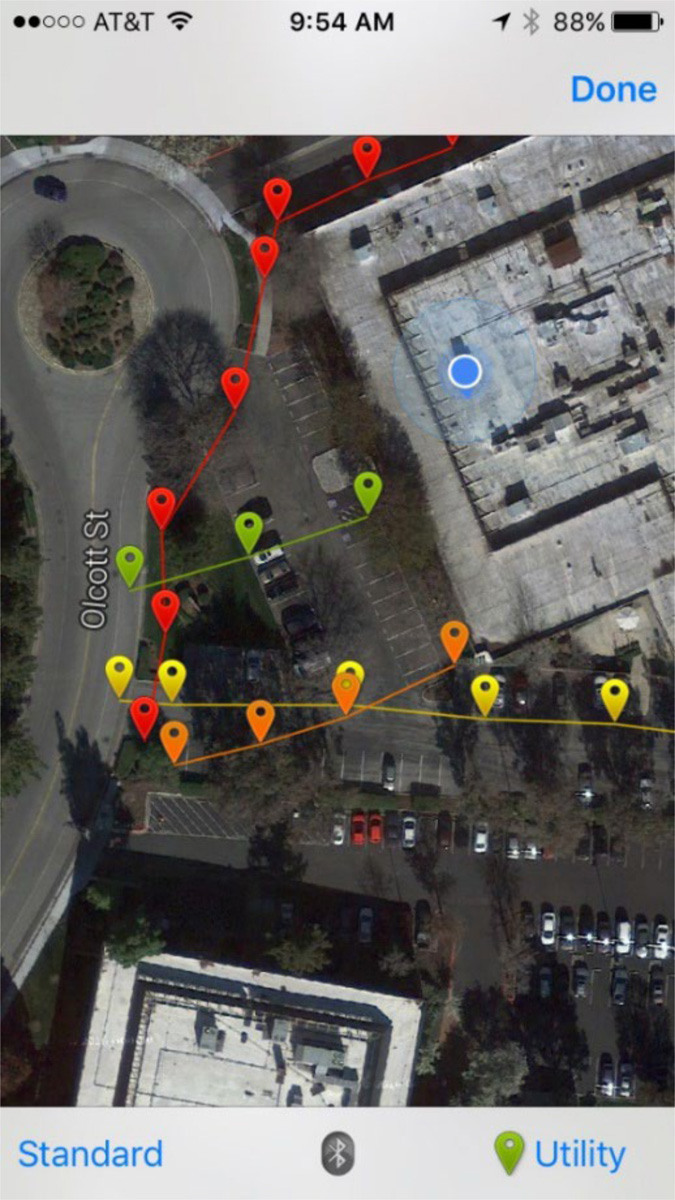
Vivax-Metrotech VMMap Utility Mapping App
The VMMap Utility Mapping App from Vivax-Metrotech enables field technicians to capture and manage utility mapping data in real time from a vLoc3 series sonde or utility locator. Location data can be collected using the mobile device’s built-in GPS or an external GPS receiver of your choice for enhanced positioning accuracy. The app records critical survey information including GPS coordinates, depth measurements and distances between locate points in detailed data logs. Collected data can be exported in multiple industry-standard formats, including CSV, KML, SHP, TXT, XLS and XLSX. It also features integrated image capture functionality, allowing users to attach JPG images directly to surveys. This feature is ideal for documenting points of interest, site conditions or completed locate work for improved recordkeeping and reporting. With real-time map generation, it provides field crews with immediate visual confirmation of collected data, helping ensure accuracy, efficiency and confidence throughout the mapping process. 408-734-1400; www.vxmt.com
Smoke Locators
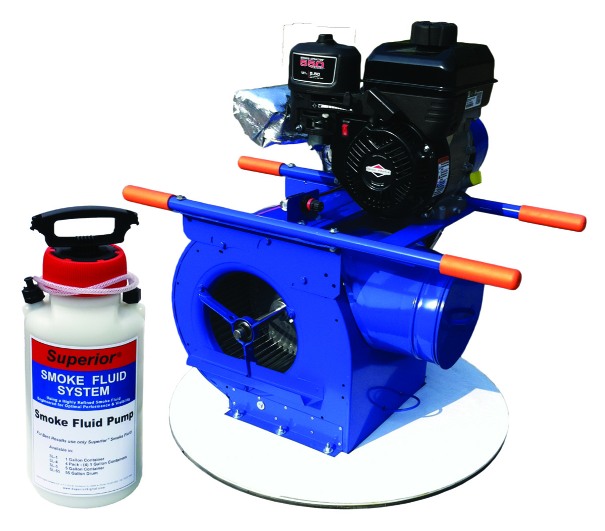
Superior Signal Smoke Fluid Systems
Superior Signal Smoke Fluid Systems are used to find faults and sources of surface water inflow in collection systems. Smoke fluid is both a high quality and economically priced fluid. All blowers are engineered for smoke testing, using a double insulated heating chamber with stainless steel injector to maximize dry smoke output and produce the best quality liquid-based smoke. The technique has been the Industry dtandard in smoke testing since 1961. It meets WEF and NASSCO standards, and is widely used in tests to meet EPA, ASHRAE, OSHA and NFPA standards. Systems are used to find faults and sources of surface water inflow in collection systems. 800-945-8378; www.superiorsignal.com
Software

ADS Environmental Services SLiiCER Software Suite
The SLiiCER Software Suite from ADS Environmental Services seamlessly pulls together all relevant I&I data in one place and gives system engineers an extensive set of analysis tools to create I&I studies, identify rainfall events, track sewer performance, compare dry-day vs. wet-day performance, map diurnal curves and evaluate capital improvement rehab projects aimed at reducing I&I. The SLiiCER app, integrated within the ADS PRISM platform, leverages seamless data integration, trusted analytics and flexible reporting in a single, unified platform. 877-237-9585; www.adsenv.com
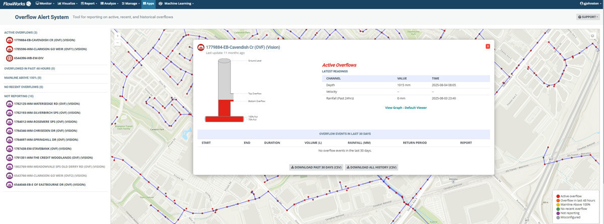
infinitii ai flowworks Overflow Risk Mitigation & Regulatory Compliance System
Overflow events in sanitary sewer networks involve regulatory exposure, environmental harm and costly post-event investigations. Yet most municipalities still rely on fragmented, after-the-fact reporting to understand what actually happened in their collection system. Providing real-time as well as predictive visibility, fast response and defensible documentation with existing staff and data has historically been out of reach. The flowworks Overflow Risk Mitigation & Regulatory Compliance System from infinitii ai solves this problem, making overflow alert data available to designated operators and administrators. An interactive GIS map displays overflow sites and the entire flow monitoring network with live status overlays as well as machine learning-enabled predictive status. Selecting any site opens a drilldown view with current readings, pipe fill graphics, threshold indicators and the complete overflow event table for that location. When a regulator asks for overflow documentation, the system produces structured, audit-ready records automatically for every event, with no manual steps between the event and the report. 514-591-8295; www.infinitii.ai
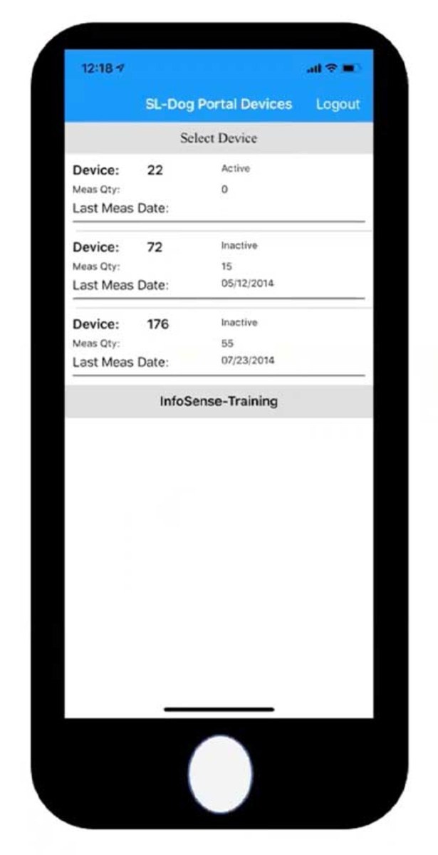
InfoSense SL-DOG
The SL-DOG mobile app from InfoSense is designed to improve how field crews collect and manage acoustic inspection data. The updated app introduces a clean interface and more streamlined workflow for day-to-day use. Crews can quickly log asset IDs, add notes and capture inspection details directly in the field. The app integrates with the broader SL-DOG platform, allowing acoustic data to sync with the web portal for review, quality control and reporting. This ensures that information collected in the field is available for analysis and decision-making. Overall, the mobile app is built to make field data collection faster, more consistent and easier to manage, helping utilities turn acoustic inspection data into actionable maintenance decisions. It is available on iOS and Android. 877-747-3245; www.infosense.com

ITpipes SmartVision
SmartVision from ITpipes links CCTV crews and office teams in one seamless workflow, so field-captured data instantly supports office decisions. Integrating with all major CCTV hardware, crews capture detailed inspection data on site while office teams receive real-time updates, interactive GIS mapping and powerful reports. Dynamic reporting streamlines review, QA and planning. As an Esri Gold Partner solution with deep GIS integration, it offers bidirectional integrations with leading AMS partners including Trimble Cityworks, OpenGov EAM (formerly Cartegraph), Novotx Elements and many others. These connections enable seamless work order management and automatic condition data syncing to support capital planning, eliminating manual workflows between ITpipes and the systems you already use. 505-355-6829; www.itpipes.com
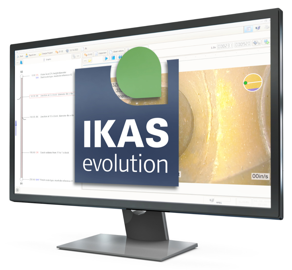
RapidView IBAK North America IKAS Evolution
RapidView IBAK North America’s IKAS Evolution software works directly with your inspection system to turn field data into clean reports so you can make the right decision on your sewer network faster. Reports are easy to read and share, so everyone on your team stays on the same page. Personalized workflows give the operator more control and fit the software to match their own inspection process and data systems. Add powerful tools like digital HD recording, 3D GeoSense mapping and laser measurement to get even more out of every inspection. All of this feeds into organized reports with up to date coding standards. 800-656-4225; www.rapidview.com

WICKED Product Suite WICKED ANALYZER
The WICKED ANALYZER from the WICKED Product Suite is a comprehensive platform designed to support the full life cycle of underground infrastructure management by leveraging historical data, intelligent analytics and workflow automation to help organizations plan, track and optimize rehabilitation, repair and inspection operations. It effectively centralizes the management of underground infrastructure assets, allowing for the use of historical inspection data to analyze condition, predict deterioration and recommend rehabilitation or repair actions. It supports complete workflow management for inspections, cleaning, repairs and rehabilitation, allowing crews to tailor assessment criteria to match the organization’s standards. It can generate consistent recommendations for projects, crews and individual assets. It lets crew members track expenses associated with inspections, cleaning, repairs and rehabilitation tasks. 561-670-5302; wicked-software.com
Sonar Profiling
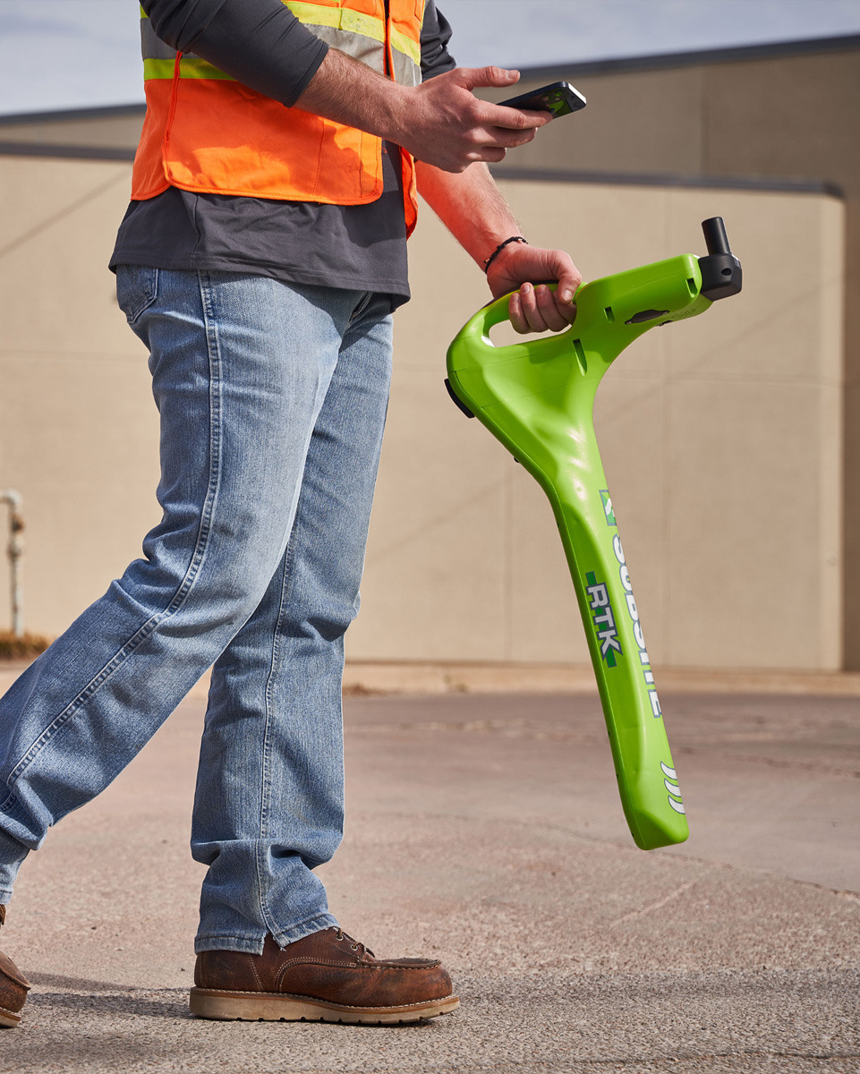
Subsite Electronics UtiliGuard 2 RTK
The UtiliGuard 2 RTK (real-time kinematic) receiver from Subsite Electronics is designed with survey-grade technology and dual-band antennas to deliver centimeter-grade accuracy, making it an ideal solution for locating abandoned and untracked utilities that are often difficult to pinpoint. Its high-precision capabilities provide insights into underground infrastructure, helping crews avoid cross bores during future projects. Like the UtiliGuard 2 Standard and Advanced units, the RTK receiver features integrated data capture, GPS positioning and an intuitive user interface to improve work quality and maximize locate awareness. Additional enhancements include dead-reckoning capabilities, which help operators maintain accurate locates in heavy tree canopy or areas where GPS signals falter. A multifrequency fault-finding capability also allows contractors to accurately identify and locate faulted power lines using a broad spectrum of customizable frequencies, up to 10 kHz. 800-846-2713; www.subsite.com
Surveying/Mapping
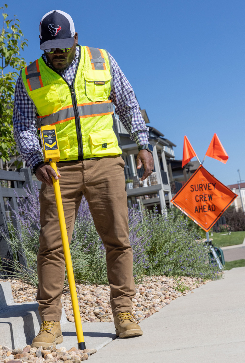
Schonstedt GA52Cx Magnetic Locator
The Schonstedt GA52Cx Magnetic Locator is designed to detect ferrous objects such as survey markers, manhole covers, valve and curb boxes, and cast-iron pipe joints. High sensitivity with five levels helps users locate buried ferrous objects in demanding surveying and utility locating environments without responding to aluminum, brass or copper. It uses dual-sensor HeliFlux technology and rugged, modular construction in an aluminum casing to support long service life across a wide range of temperatures and field conditions. It is powered by two 9-volt batteries, providing up to 40 hours of intermittent operation, and it features an audio output with an idle tone that increases or decreases with magnetic field intensity. Its overall length is 42.5 inches, with a waterproof section of 34.5 inches, and the locator weighs approximately 2.5 pounds. It now features an ergonomic handgrip that encourages proper handling to help reduce stress on the chassis. 800-999-8280; www.schonstedt.com
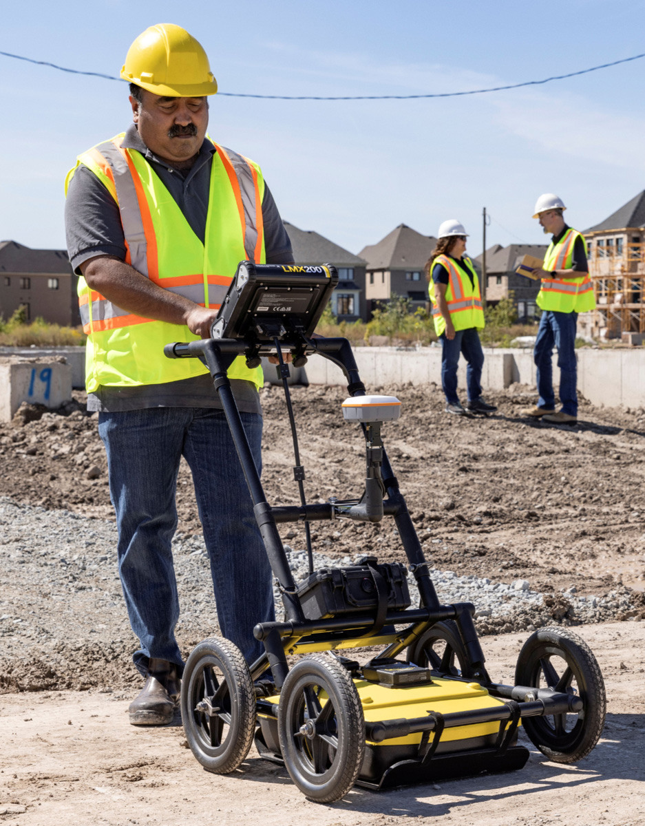
Sensors & Software LMX200SG
The LMX200SG ground-penetrating radar from Sensors & Software supports the detection and mapping of metallic and nonmetallic utilities, underground tanks and nonutility structures. It integrates a plug-and-play GNSS receiver for accurate positioning in utility mapping applications. A preconfigured Juniper Systems Geode GNSS receiver provides 30 cm RMS accuracy (with SBAS). The RTK upgrade supports 20 cm RMS (with Galileo HAS) or 1 cm RMS (with RTK corrections, not included). GNSS data is logged at 10 Hz and fully integrated with the GPR data, simplifying field data collection. The integrated GNSS allows the generation of in-field depth slices of the survey area to help identify utilities. Paths of utilities located can be wirelessly exported to compatible mapping applications (not included). The GPR battery supplies power, eliminating the need for separate GNSS battery management. 800-267-6013; www.sensoft.ca

Xylem SmartBall x
Xylem’s next-generation SmartBall x pipeline inspection platform combines leak and gas pocket detection with XYZ pipeline mapping and pressure profiling in one, nondisruptive assessment. It helps utilities manage critical water and wastewater pipelines by identifying leaks and other threats and improving the accuracy of pipeline records. Xylem now provides same-day preliminary results, and digital reporting replaces static paper reports, making it easier to visualize findings, integrate results into asset management systems, and respond to threats. It collects location and condition data in a single inspection run, reducing field time and effort. The tool offers the same operational simplicity as the previous SmartBall platform, including easy access through existing features and long-distance inspections without service disruption. 800-247-8674; www.xylem.com
Continue reading for free