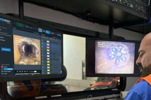
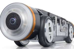
Crawler Camera
RapidView IBAK North America PANORAMO 4K
The PANORAMO 4K from RapidView IBAK North America captures everything as it moves, with twin 185-degree cameras simultaneously capturing sharp 4K images at speeds up to 69 feet per minute. Collect all the data in the field, then analyze it back in the office. There’s no need to make decisions on the fly. The technology was designed to have fewer moving parts than traditional inspection systems, which translates to fewer breakdowns and more production. It offers three distinct views for analysis (360 degree, unfolded and geometric), high image quality, and an increase in efficiency. On average, crews can inspect more than twice the amount of pipe per day. 800-656-4225; www.rapidview.com
Mainline TV Camera System
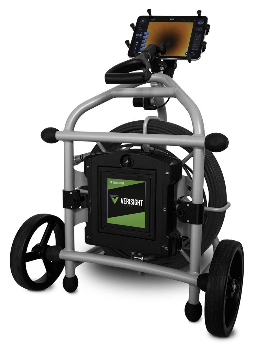
Envirosight Verisight Ultra
The Verisight Ultra from Envirosight simplifies workflows while delivering exceptional image quality. It includes a 1080p full HD touchscreen monitor, which records hi-def video and photos to enable quick and accurate identification of blockages, defects and other issues that may compromise the functionality and safety of underground pipelines. Self-leveling pan-and-tilt advanced camera control options are available. It also has a compact and lightweight design for easy maneuverability through tight spaces and uneven terrain. The system offers the ability to perform inspections standing up or on its side for added versatility on uneven ground. It offers the choice of 200 or 330 feet of “built for distance” cables. 866-936-8476; www.envirosight.com
Pipeline Surveying and Mapping
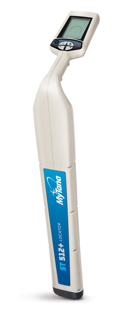
MyTana MT 512+ Locator
Accurate and easy to use, the MT 512+ Locator from MyTana is designed for sewer and drain contractors to pinpoint the location of 512 Hz signal transmission in all pipes, with the capability to detect many other frequencies. A large, high-contrast LCD display clearly shows signal response in bright sunshine or shadows and displays real time data including continuous depth, signal strength and directional arrows that guide you to the target location. Audio response supplements the visual data. It is powered by a long-lasting, rechargeable lithium-ion battery. Alone, it not only detects 512 Hz signal from all MyTana cameras as well as other sondes, but also 640 Hz, 815 Hz, 8 kHz and 33 kHz signals. Partner with MyTana’s LineFinder Transmitter to expand the frequency range and pinpoint the location of buried utilities. It lets you take advantage of seven line-tracing modes in addition to sonde mode. 866-948-7576; www.mytana.com
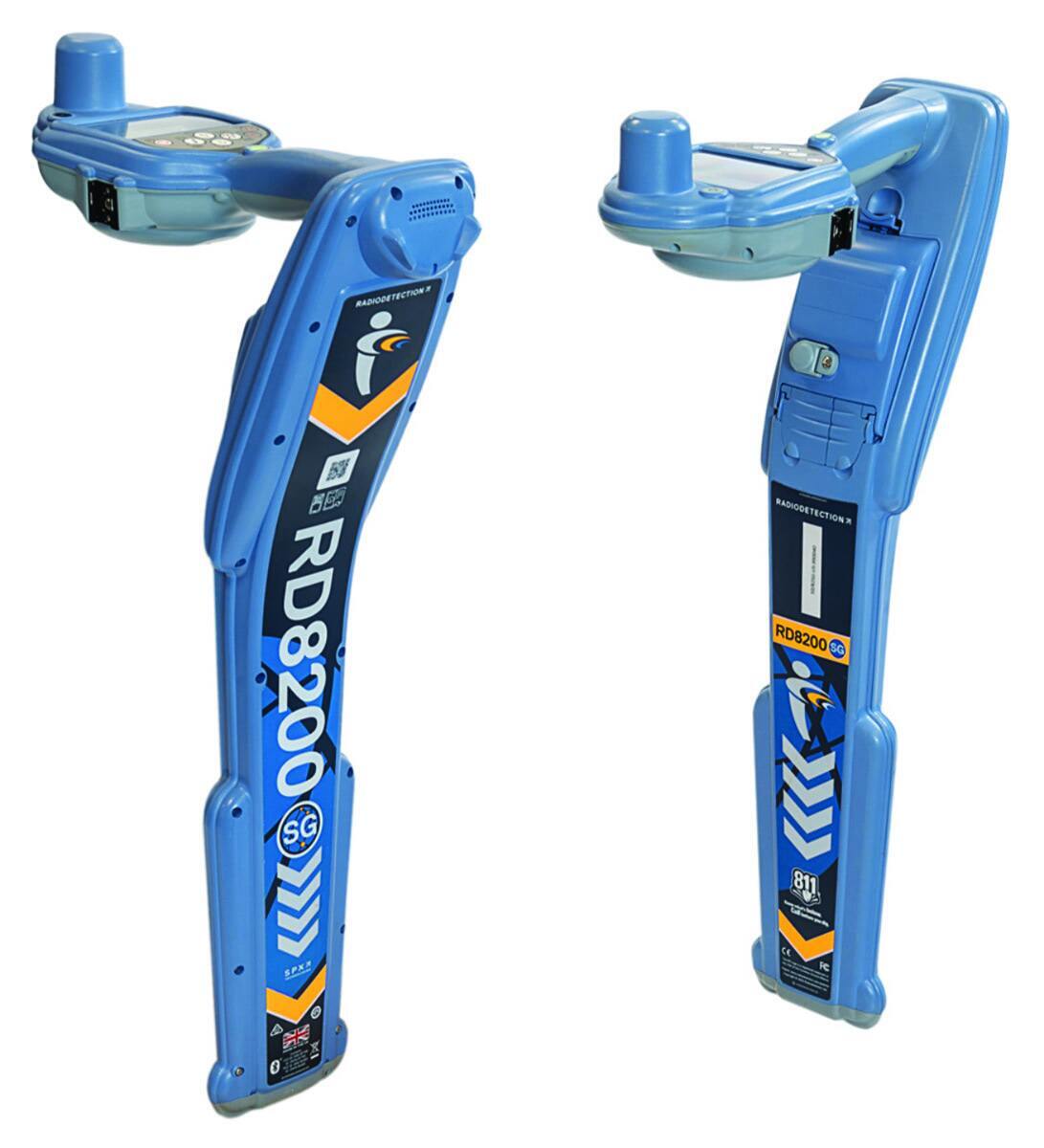
Radiodetection RD8200SG
Locate and map buried utilities in a single operation with Radiodetection’s RD8200SG survey-grade precision locator. Equipped with an integrated GNSS antenna, users can simultaneously view and build maps with survey-grade accuracy on a mobile phone while locating. It is a turnkey solution for those new to utility mapping, while utility mapping experts can connect into advanced systems. It excels in locating buried utilities, with features such as technology that rejects strong interfering signals, current direction to identify targets among a number of parallel utilities, and StrikeAlert to warn of shallow cables, reducing the risk of accidents or damage to buried infrastructure. An ergonomic, lightweight design ensures comfort during extended use, while automatic usage logging and swing warnings promote proper handling and enhance safety. 877-247-3797; www.radiodetection.com
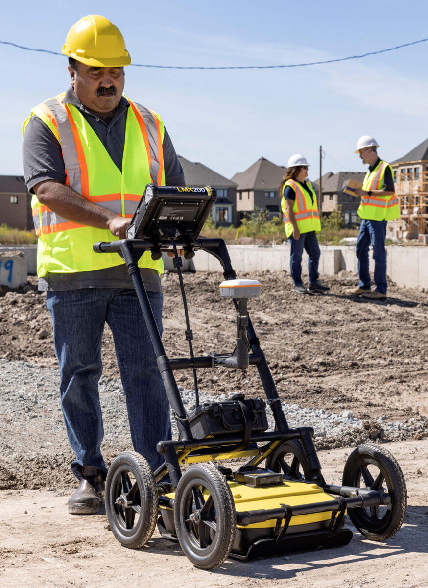
Sensors & Software LMX200-SG
The LMX200-SG (Survey Grade) from Sensors & Software integrates the LMX200 GPR system with a plug-and-play GNSS accessory for accurate positioning in utility mapping applications. It detects and maps metallic and nonmetallic utilities, underground tanks and no-utility structures. The system includes a preconfigured Juniper Geode GNSS receiver offering 30 cm RMS accuracy (with SBAS). The RTK upgrade enables 20 cm RMS (with Galileo HAS) or 1 cm RMS (with RTK corrections, not included). GNSS data is logged at 10 Hz and fully integrated with GPR data, simplifying field collection and post-processing. Power is supplied from the GPR system battery, eliminating the need for separate GNSS battery management. It is compatible with EKKO_Project software for data analysis and export. 800-267-6013; www.sensoft.ca
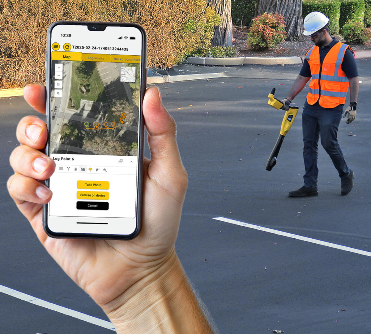
Vivax-Metrotech vLoc3 RTK-Pro
Utility technicians often rely on multiple devices (GNSS receivers, data loggers, radios) to gather and transmit accurate location data. This setup can slow down fieldwork, increase training time and complicate data handling. The vLoc3 RTK-Pro locating and mapping system from Vivax-Metrotech simplifies the process by combining high-accuracy electromagnetic locating with built-in RTK GNSS and direct cellular connectivity to the free cloud. In real-world scenarios, technicians use it to locate buried utilities and automatically upload precise data in real time — no external equipment or manual transfers required. It offers EM locating, RTK GNSS, Bluetooth and cellular in one device. 408-734-3880; www.vivax-metrotech.com
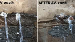
Pipeline Testing Equipment
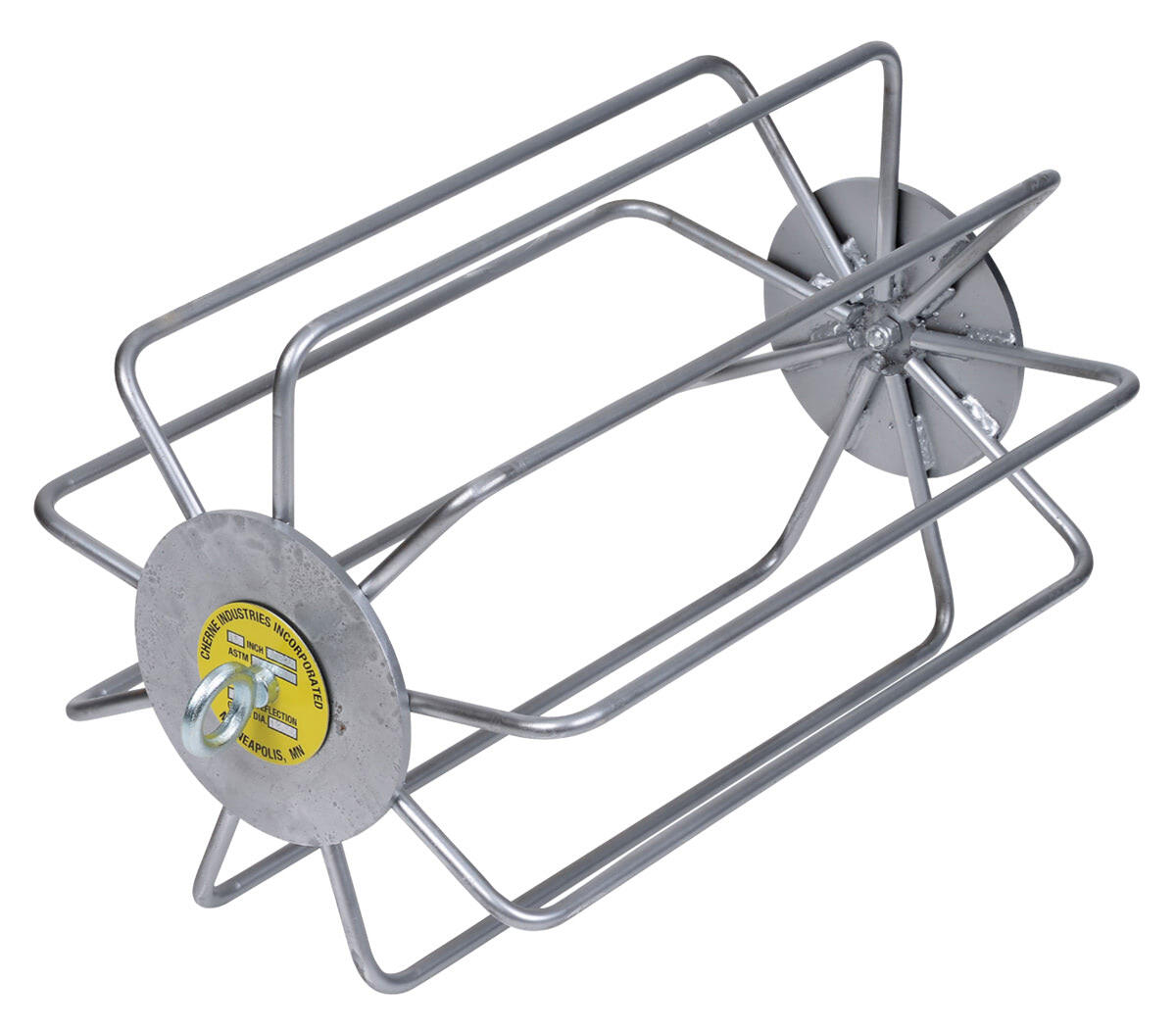
Cherne Deflection Gauges
Cherne Deflection Gauges, which include fixed steel and aluminum, are used to test flexible sewer pipe for out-of-roundness or deflection, per ASTM specifications D3034 and F679. This testing ensures that flexible pipe has been properly bedded and backfilled (ASTM D2321) to give optimal performance. Durable, zinc-plated construction resists corrosion. They conform to mandrel sizing specifications, so blade length is equal to or greater than the nominal pipe size. The nine-arm design ensures testing accuracy, while open design allows gravel and debris to pass through. 800-843-7584; www.cherneind.com
Surveying
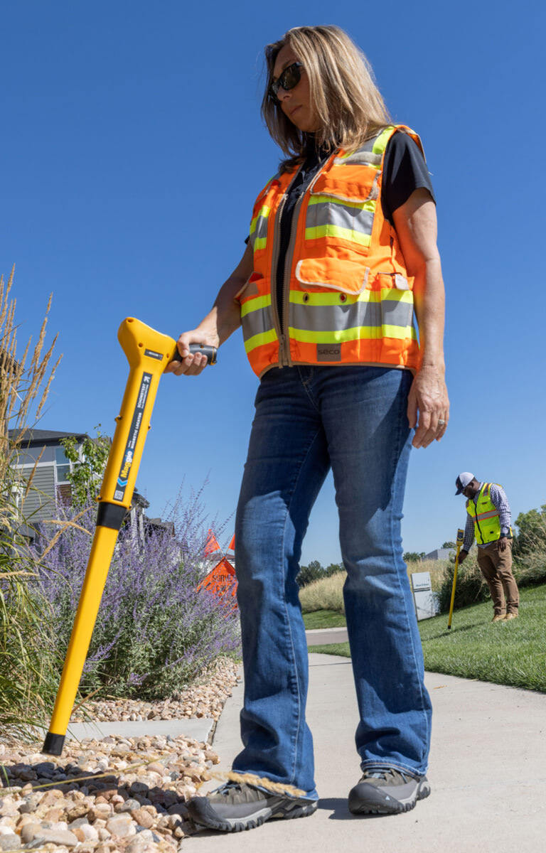
Schonstedt Maggie Magnetic Locator
The Schonstedt Maggie Magnetic Locator combines the best features of two flagship models: the precision and sensitivity of the GA-52Cx with the single-handed operation of the GA-92XTd. Designed for locating ferrous objects (iron and steel) underground, it combines performance and comfort in a lightweight, ergonomic design. With HeliFlux sensors for maximum sensitivity, it provides clear audio and visual feedback, including an expanding bar graph that indicates polarity and signal strength. It features a four-level gain adjustment, a 24-hour battery life and an easy-access battery compartment for quick replacements in the field. Rated IP54 for dust and water resistance, it is built to withstand tough environments. Weighing just 2.6 pounds, it includes a soft case and sling for hands-free carrying in rough terrain. 888-367-7014; www.schonstedt.com
Software

CUES GraniteNet AI Defect Coding Service
CUES GraniteNet AI Defect Coding Service lets machines process video using AI for consistent accuracy, speed-to-completion, and final review done by PACP-certified inspectors. Prescriptive Planning is based on the results of the AI-processed inspections to help prioritize risk and organize the types of work that should be done, along with the suggested method of repair/replacement — based on out-of-the-box or customized decision logic. Quantify the type of work, assess budgets and streamline contractor bids for the specific rehabilitation jobs needed to be done. 800-327-7791; www.cuesinc.com

ITpipes Web
ITpipes Web empowers municipalities, utilities and contractors to manage, review and act on field inspection data in the office. Purpose-built for sewer inspection workflows, it offers seamless visibility into inspection progress, quality control and work order status — all backed by real-time cloud syncing and Esri GIS integration. With dynamic SmartTabs for filtering and spatial analysis, users can easily identify high-risk assets and prioritize maintenance. The Inspection Viewer provides a full view of each inspection, allowing teams to review, compare and share results instantly. Customizable templates and NASSCO validation supports industry compliance, while centralized admin tools ensure secure role-based access. Streamlined import options, API integrations and automated reporting deliver faster collaboration and decision-making. From powerful mapping to direct AMS integration, it streamlines data processes and enables teams to prioritize system performance and proactive maintenance. 505-355-6829; www.itpipes.com

PipeTech Software Hub
Managing sewer inspection workflows can be complex, slow and prone to errors. Inspections get lost, reporting takes days, and critical business insights remain buried in scattered spreadsheets. Hub from PipeTech Software solves these challenges by streamlining the entire inspection process in one intuitive, cloud-based platform. Easily assign inspections to field crews or subcontractors and watch as results sync back in real time. Inspections can be QCed in the cloud or even autocoded using AI powered by Pallon. Built-in dashboards turn incoming data into clear, actionable insights, making it easy to monitor progress, identify bottlenecks and spot trends at a glance. Data can be shared with external stakeholders via a free, zero-download viewer, and made available in systems like Esri, Cartegraph, CityWorks or Lucity. Municipalities, contractors and engineers can quickly identify asset issues, prioritize maintenance and make data-driven rehab decisions. 888-505-0214; www.pipetech.com
Continue reading for free